Click to visit the main New York Public Library Homepage
The New York Public Library
Digital Collections
About Digital Collections
Browse
Search only public domain materials
Items
Collections
Divisions
Home
Search
Browse
About
Search only public domain materials
Items
Collections
Divisions
Digital Collections
Using Images
Using Data
Search
Keyword search
Show filters
Hide filters
Show Only Public Domain
topic
Real property
11050
Fire insurance
5305
Cities & towns
5016
City planning
1101
Social conditions
946
More
Less
name
Sanborn Map Company
5108
G.W. Bromley & Co
2551
New York (N.Y.). City Planning Commission
980
M.I.T. Press
942
Bromley, George Washington
857
More
Less
collection
Atlases of New York City
11722
Atlases of the United States
3868
Maps of North America
3345
Maps of New York City and State
2059
Lawrence H. Slaughter Collection of English maps, charts, globes, books and atlases
1248
More
Less
place
New York (State)
14041
New York
5623
New York (N.Y.)
3511
Manhattan (New York, N.Y.)
2385
Brooklyn (New York, N.Y.)
1222
More
Less
genre
Maps
25784
Atlases
3791
Prints
1409
Topographic maps
1062
Surveys
1034
More
Less
publisher
Sanborn Map Company
5145
G.W. Bromley & Co
2371
MIT Press
942
E. Belcher Hyde
807
K.u.K. Militargeographisches Institut
774
More
Less
division
Map Division
23798
Manuscripts and Archives Division
1281
Wallach Division: Print Collection
746
Rare Book Division
518
Dorot Jewish Division
477
More
Less
type
cartographic
24808
still image
3764
text
2059
notated music
10
sound recording
3
More
Less
Date Range
to
Looking for one of these collections?
Atlases of New York City
11,722 items
Atlases of the United States
3,868 items
Maps of North America
3,345 items
Maps of New York City and State
2,059 items
Lawrence H. Slaughter Collection of English maps, charts, globes, books and atlases
1,252 items
Bancker plans
1,080 items
28,754 results found for:
New York Maps
Sort by:
Relevance
Title
Date created
Date digitized
Sequence
Results 1251 - 1300
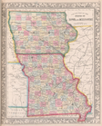
County
map
of the States of Iowa
use:
… partner (e.g.,
New
York
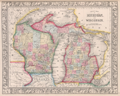
County
map
of Michigan, and Wisconsin.
use:
… partner (e.g.,
New
York
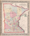
County
map
of Minnesota.
use:
… partner (e.g.,
New
York
Map
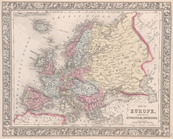
of Europe, showing its gt. political
use:
… partner (e.g.,
New
York
County
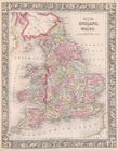
map
of England and Wales.
use:
… partner (e.g.,
New
York
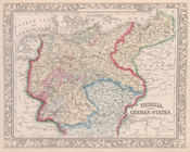
Prussia, and the German State…
use:
… partner (e.g.,
New
York
Map
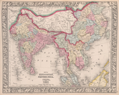
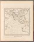
of Hindoostan, Farther India, China
use:
… partner (e.g.,
New
York
List of Post Offices in the U…
use:
… partner (e.g.,
New
York
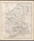
Poland (Polska): divided into…
use:
… partner (e.g.,
New
York
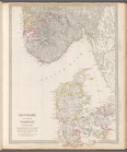
Denmark and part of Norway (D…
use:
… partner (e.g.,
New
York
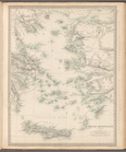
Grecian Archipelago (ancient)
use:
… partner (e.g.,
New
York
Ancient Greece: Northern part
use:
… partner (e.g.,
New
York
The northern provinces of Swe…
use:
… partner (e.g.,
New
York
Russia in Europe, Part X, gen…
use:
… partner (e.g.,
New
York
Turkey II: containing the Nor…
use:
… partner (e.g.,
New
York
Turkey III: containing the So…
use:
… partner (e.g.,
New
York
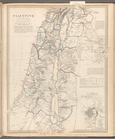
Palestine with the Hauran and…
use:
… partner (e.g.,
New
York
Russia in Europe, Part IX and…
use:
… partner (e.g.,
New
York
The Turkish Empire in Europe …
use:
… partner (e.g.,
New
York
Ancient Macedonia, Thracia, I…
use:
… partner (e.g.,
New
York
Turkey containing the provinc…
use:
… partner (e.g.,
New
York
The Eastern part of the Ancie…
use:
… partner (e.g.,
New
York
The Panjab with part of Afgha…
use:
… partner (e.g.,
New
York
Persia with part of the Ottom…
use:
… partner (e.g.,
New
York
Western Siberia, Independent …
use:
… partner (e.g.,
New
York
China and the Birman Empire: …
use:
… partner (e.g.,
New
York
m
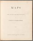
Maps
of the Society for the Diffusion of Useful
use:
… partner (e.g.,
New
York
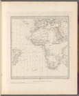
America noviter delineata.
use:
… partner (e.g.,
New
York
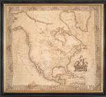
A General
map
of America divided into North
use:
… partner (e.g.,
New
York
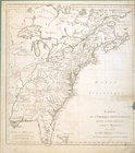
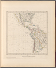
North America
use:
… partner (e.g.,
New
York
N. America
use:
… partner (e.g.,
New
York
Amerique septentrionale divis…
use:
… partner (e.g.,
New
York
North America
use:
… partner (e.g.,
New
York
Carte de l'Amérique septentri…
use:
… partner (e.g.,
New
York
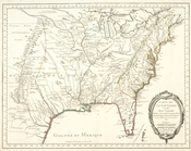
Carte de la Louisiane et pais…
use:
… partner (e.g.,
New
York
m
Maps
of the Society for the Diffusion of Useful
use:
… partner (e.g.,
New
York
World on gnomonic projection …
use:
… partner (e.g.,
New
York
England with its canals and r…
use:
… partner (e.g.,
New
York
The world on Mercator's proje…
use:
… partner (e.g.,
New
York
World on gnomonic projection …
use:
… partner (e.g.,
New
York
Maps
of the Society for the Diffusion of Useful
use:
… partner (e.g.,
New
York
m
Maps
of the Society for the Diffusion of Useful
use:
… partner (e.g.,
New
York
Maps
of the Society for the Diffusion of Useful
use:
… partner (e.g.,
New
York
World on gnomonic projection …
use:
… partner (e.g.,
New
York
World on gnomonic projection …
use:
… partner (e.g.,
New
York
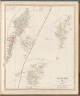
Scotland III: Orkneys, Shetla…
use:
… partner (e.g.,
New
York
World on gnomonic projection …
use:
… partner (e.g.,
New
York
World on gnomonic projection …
use:
… partner (e.g.,
New
York
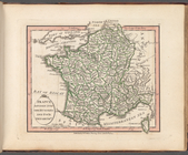
France divided into one hundr…
use:
… partner (e.g.,
New
York
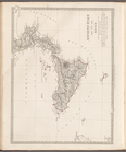
Ancient Italy part III, and S…
use:
… partner (e.g.,
New
York
1
2
3
4
5
6
7
8
9
10
…
115
116
Previous
Next
1
2
3
4
5
6
7
8
9
10
…
115
116
Previous
Next