Click to visit the main New York Public Library Homepage
The New York Public Library
Digital Collections
About Digital Collections
Browse
Search only public domain materials
Items
Collections
Divisions
Home
Search
Browse
About
Search only public domain materials
Items
Collections
Divisions
Digital Collections
Using Images
Using Data
Search
Keyword search
Show filters
Hide filters
Show Only Public Domain
topic
Real property
10889
Fire insurance
5305
Cities & towns
5007
City planning
1087
Social conditions
942
More
Less
name
Sanborn Map Company
5108
G.W. Bromley & Co
2551
New York (N.Y.). City Planning Commission
980
M.I.T. Press
942
Bromley, George Washington
857
More
Less
collection
Atlases of New York City
11592
Atlases of the United States
3839
Maps of North America
3345
Maps of New York City and State
2057
Lawrence H. Slaughter Collection of English maps, charts, globes, books and atlases
1248
More
Less
place
New York (State)
13188
New York
4898
New York (N.Y.)
3363
Manhattan (New York, N.Y.)
2239
Brooklyn (New York, N.Y.)
1212
More
Less
genre
Maps
23269
Atlases
3762
Topographic maps
1050
Cadastral maps
594
Nautical charts
394
More
Less
publisher
Sanborn Map Company
5145
G.W. Bromley & Co
2371
MIT Press
942
E. Belcher Hyde
807
K.u.K. Militargeographisches Institut
774
More
Less
division
Map Division
23798
Wallach Division: Print Collection
350
Billy Rose Theatre Division
185
Jerome Robbins Dance Division
178
Wallach Division: Picture Collection
141
More
Less
type
cartographic
22274
still image
2322
text
911
moving image
92
notated music
19
More
Less
Date Range
to
Looking for one of these collections?
Atlases of New York City
11,722 items
Atlases of the United States
3,868 items
Maps of North America
3,345 items
Maps of New York City and State
2,059 items
Lawrence H. Slaughter Collection of English maps, charts, globes, books and atlases
1,252 items
Spezialkarte der Osterreichisch-Ungarischen Monarchie
774 items
25,041 results found for:
Princesses
Sort by:
Relevance
Title
Date created
Date digitized
Sequence
Results 22751 - 22800
Bounded by S. 11th Street, Be…
Bounded by Noble St., Manhatt…
Bounded by E. 17th St., Foste…
Colton's railroad & township …
Bounded by Bayview Ave., (Gra…
m
Afro American travel map
Bounded by West St., (Brookly…
Southern part of Yonkers, and…
Agricultural and geological m…
Bounded by Nostrand Ave., Ave…
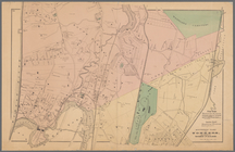
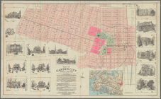
Map of Garden City, Queens Co…
Topographical sketch of the g…
Driving road chart of Westche…
Bounded by Avenue E (Ditmas A…
m
Rand, McNally & Co.'s complet…
Rand, McNally & Co.'s new aut…
Rapid transit map of Kings, Q…
Map of the New York wildernes…
Railroads in Manhattan, Jerse…
Plan of the attack on forts C…
Map of Hudson & Manhattan Rai…
Bounded by Ocean Parkway, Ave…
Bounded by (Atlantic Ocean, M…
m
Goulding's directory map of N…
Karte von Amerika: zum gebrau…
A Plan of the Straits of St. …
m
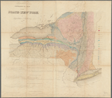
Preliminary geologic map of N…
m
A map of the provinces of New…
Robinsons Real Estate Atlas o…
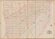
Part of 12th Ward, between 86…
Map of the New York Wildernes…
Plan of West Point
[Map bounded by Crescent St.,…
Vrbium Londini et West-Monast…
Map of the Manor of Scarsdale
Lower right section of a shee…
Onondaga County & adjacent te…
m
City of New York, map of the …
The Matthews-Northrup up-to-d…
Untitled manuscript map of Gr…
Western Division of the Erie …
Brooklyn, from Rand McNally m…
m
Map of Delaware Co., New York
Map or plan of section 10 [Cr…
Geological sketch of Philadel…
m
America
Map of the city of Yonkers, S…
Map of Kings and part of Quee…
[Map bounded by 150th Ave., C…
Map of the New York City metr…
1
2
…
89
90
91
92
93
94
95
96
…
100
101
Previous
Next
1
2
…
89
90
91
92
93
94
95
96
…
100
101
Previous
Next