Click to visit the main New York Public Library Homepage
The New York Public Library
Digital Collections
About Digital Collections
Browse
Search only public domain materials
Items
Collections
Divisions
Home
Search
Browse
About
Search only public domain materials
Items
Collections
Divisions
Digital Collections
Using Images
Using Data
Search
Keyword search
Show filters
Hide filters
Show Only Public Domain
topic
Real property
11050
Fire insurance
5305
Cities & towns
5016
City planning
1101
Social conditions
946
More
Less
name
Sanborn Map Company
5108
G.W. Bromley & Co
2551
New York (N.Y.). City Planning Commission
980
M.I.T. Press
942
Bromley, George Washington
857
More
Less
collection
Atlases of New York City
11722
Atlases of the United States
3868
Maps of North America
3345
Maps of New York City and State
2059
Lawrence H. Slaughter Collection of English maps, charts, globes, books and atlases
1252
More
Less
place
New York (State)
14041
New York
5623
New York (N.Y.)
3511
Manhattan (New York, N.Y.)
2385
Brooklyn (New York, N.Y.)
1222
More
Less
genre
Maps
25787
Atlases
3791
Prints
1428
Topographic maps
1062
Surveys
1034
More
Less
publisher
Sanborn Map Company
5145
G.W. Bromley & Co
2371
MIT Press
942
E. Belcher Hyde
807
K.u.K. Militargeographisches Institut
774
More
Less
division
Map Division
23798
Manuscripts and Archives Division
1281
Wallach Division: Print Collection
746
Rare Book Division
518
Dorot Jewish Division
477
More
Less
type
cartographic
24808
still image
3785
text
2063
notated music
10
sound recording
3
More
Less
Date Range
to
Looking for one of these collections?
Atlases of New York City
11,722 items
Atlases of the United States
3,868 items
Maps of North America
3,345 items
Maps of New York City and State
2,059 items
Lawrence H. Slaughter Collection of English maps, charts, globes, books and atlases
1,252 items
Bancker plans
1,080 items
28,779 results found for:
maps
Sort by:
Relevance
Title
Date created
Date digitized
Sequence
Results 26751 - 26800
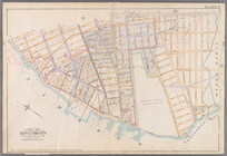
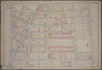
Bounded by Charles Street, Wa…
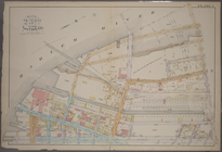
Bounded by W. 14th Street, Si…
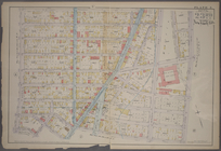
Plate 15: Bounded by Congress…
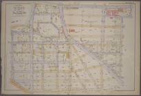
Plate 30: Bounded by Seneca A…
Plate 32: Bounded by Greene A…
Plate 33: Bounded by Atlantic…
Plate 34: Bounded by Ralph Av…
Plate 9: [Bounded by S. 11th …
Plate 13: [Bounded by Calyer …
Plate 31: [Bounded by Richard…
Plate 5:
Map
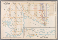
of New York and vicinity
Plate 17:
Map
of the Woodlawn Cemetery
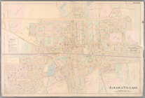
Plate 24: Northern part of To…
Plate 49: Town of North Castl…
Plate 57: Town of Lewisboro, …
Plate 61: Town of Yorktown, W…
Plate 63: Town of North Salem…
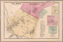
Plate 67: Cold Spring - Nelso…
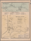
Plate 70: Patterson, Town of …
m
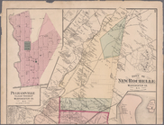
Plates 53 & 54: Town of New R…
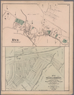
Plate 66: Rye, Town of Westchester Co. N.Y. -
Map
Plate 8: [Bounded by Mackay P…
Plate 9: [Bounded by 85th Str…
Plate 31: [Bounded by Avenue …
Bounded by Hudson Street, Joh…
Plate 8: [Bounded by Hillside…
Plate 2: [Bounded by E. 144th…
Plate 3: [Bounded by River Av…
Plate 5: [Bounded by E. 154th…
Plate 7: [Bounded by St. Anns…
Plate 8: [Bounded by E. 164th…
Plate 9: [Bounded by E. 168th…
Plate 10: [Bounded by E. 170t…
Plate 11: [Bounded by E. 161s…
Plate 14: [Bounded by Sherida…
Plate 16: [Bounded by E. 167t…
Plate 17: [Bounded by E. 149t…
Plate 18: [Bounded by E. 138t…
Plate 19: [Bounded by Bungay …
Plate 20: [Bounded by Dongan …
Plate 21: [Bounded by Winslow…
Plate 3, Part of Section 3: […
Plate 4, Part of Section 3: […
Plate 11, Part of Section 3: …
Plate 33, Part of Section 5: …
Bounded by Carlisle Street, G…
Bounded by William Street, An…
Bounded by Reade Street, Duan…
Bounded by Jane Street, Washi…
Bounded by W. 14th Street, Se…
1
2
…
105
106
107
108
109
110
111
112
…
115
116
Previous
Next
1
2
…
105
106
107
108
109
110
111
112
…
115
116
Previous
Next