Click to visit the main New York Public Library Homepage
The New York Public Library
Digital Collections
About Digital Collections
Browse
Search only public domain materials
Items
Collections
Divisions
Home
Search
Browse
About
Search only public domain materials
Items
Collections
Divisions
Digital Collections
Using Images
Using Data
Collections
Charting America: Maps from the Lawrence H. Slaughter Collection and Others
Charting America: Maps from the Lawrence H. Slaughter Collection and Others
Navigation
Filters
Charting America: Maps from the Lawrence H. Slaughter Collection and Others
Previous
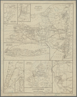
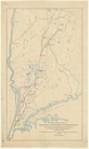
The south part of Virginia, now the north part of Carolina
0
Atlases, gazetteers, guidebooks and other books
377
Maps of the World
16
Maps of the Oceans
24
Maps of North and South America
23
Maps of North America.
551
Maps of New York City and State
1340
Lawrence H. Slaughter Collection of English maps, charts, globes, books and atlases
1020
John H. Levine Collection
60
More
Show filters
Hide filters
Show Only Public Domain
topic
Railroads
155
Real property
116
Local transit
74
Administrative and political divisions
68
Landowners
62
More
Less
name
Rand McNally and Company
25
Ohman, August R
23
Dripps, M. (Matthew)
19
Welcke, Robert A
18
C.S. Hammond & Company
17
More
Less
collection
Maps of New York City and State
517
Atlases, gazetteers, guidebooks and other books
2
Lawrence H. Slaughter Collection of English maps, charts, globes, books and atlases
1
place
x
New York
New York (State)
520
New York (N.Y.)
224
Brooklyn (New York, N.Y.)
172
Manhattan (New York, N.Y.)
150
More
Less
genre
Maps
519
Cadastral maps
35
Manuscript maps
26
Aerial views
10
Topographic maps
8
More
Less
publisher
publisher not identified
30
The Company
21
publisher unknown
20
M. Dripps
14
G.W. & C.B. Colton & Co
13
More
Less
division
Map Division
518
Manuscripts and Archives Division
2
type
cartographic
515
text
10
still image
7
Date Range
to
520 results found for:
x
New York (N.Y.)?tab=filter
Filtering on:
x
Place
: New York
Sort by:
Relevance
Title
Date created
Date digitized
Sequence
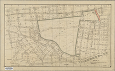
L.A.W. road maps of
New
York
Division
use:
… partner (e.g.,
New
York
Various plans and draughts of…
use:
… partner (e.g.,
New
York
m
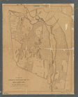
Topographical map of
New
York
City, County
use:
… partner (e.g.,
New
York
Map of watershed of Ramapo Ri…
use:
… partner (e.g.,
New
York
… of the route of the
New
Croton
use:
… partner (e.g.,
New
York
Plate II. Sketches of village…
use:
… partner (e.g.,
New
York
Plate III : Sketches of villa…
use:
… partner (e.g.,
New
York
Plate IV. Sketches of village…
use:
… partner (e.g.,
New
York
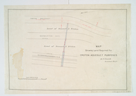
Map showing land required for…
use:
… partner (e.g.,
New
York
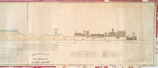
Profile of lower part of Crot…
use:
… partner (e.g.,
New
York
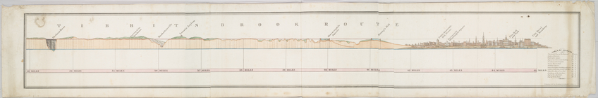
Tibbits Brook route.
use:
… partner (e.g.,
New
York
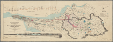
Map of the route of the
new
Croton Aqueduct
use:
… partner (e.g.,
New
York
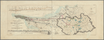
Map of the route of the
new
Croton Aqueduct
use:
… partner (e.g.,
New
York
Map of water shed of Housaton…
use:
… partner (e.g.,
New
York
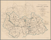
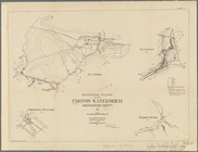
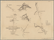
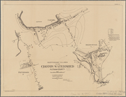
Water shed of the Croton River
use:
… partner (e.g.,
New
York
Topographical map showing the…
use:
… partner (e.g.,
New
York
Topographical map showing the…
use:
… partner (e.g.,
New
York
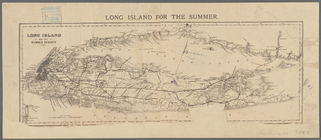
Long Island for the summer
use:
… partner (e.g.,
New
York
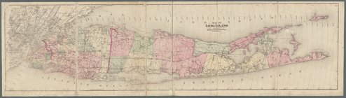
Map of Long Island
use:
… partner (e.g.,
New
York
m
Colton's
new
map of Long Island
use:
… partner (e.g.,
New
York
A plott of ye situations of t…
use:
… partner (e.g.,
New
York
m
Map of Long Island
use:
… partner (e.g.,
New
York
Map of Long Island: showing t…
use:
… partner (e.g.,
New
York
Vingboons map of Manhattan, 1…
use:
… partner (e.g.,
New
York
m
… manuscript map of
New
York
use:
… partner (e.g.,
New
York
m
… Rivers,
New
York
City
use:
… partner (e.g.,
New
York
m
… of the city of
New
York
use:
… partner (e.g.,
New
York
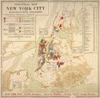
Industrial map of
New
York
City
use:
… partner (e.g.,
New
York
…
New
York
City
use:
… partner (e.g.,
New
York
m
What annexation would accompl…
use:
… partner (e.g.,
New
York
m
… portion of the City of
New
York
use:
… partner (e.g.,
New
York
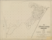
Map of the Wood Lawn Cemetery…
use:
… partner (e.g.,
New
York
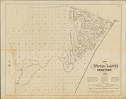
Map of the Wood Lawn Cemetery…
use:
… partner (e.g.,
New
York
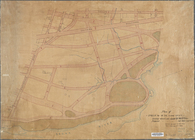
Plan of streets etc. on the L…
use:
… partner (e.g.,
New
York
m
Map of the 23rd ward,
New
York
City
use:
… partner (e.g.,
New
York
… ward of the City of
New
York
adjoining
use:
… partner (e.g.,
New
York
m
Map of upper
New
York
City and adjacent
use:
… partner (e.g.,
New
York
… in the 23d ward,
New
York
use:
… partner (e.g.,
New
York
m
Map showing steam, cable, and…
use:
… partner (e.g.,
New
York
m
Plan and profile showing the …
use:
… partner (e.g.,
New
York
m
… of the City of
New
York
...
use:
… partner (e.g.,
New
York
Map showing the location of t…
use:
… partner (e.g.,
New
York
Bronx plat map, Alexander to …
use:
… partner (e.g.,
New
York
m
General plan, Third Avenue Br…
use:
… partner (e.g.,
New
York
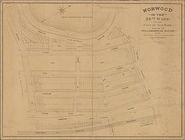
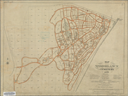
Map of the Woodlawn Cemetery
use:
… partner (e.g.,
New
York
Map or plan of section 10 [Cr…
use:
… partner (e.g.,
New
York
m
… to the
new
3rd Avenue Bridge
use:
… partner (e.g.,
New
York
m
… of
New
York
...
use:
… partner (e.g.,
New
York
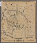
Preliminary plan of the zoological park for
New
York
use:
… partner (e.g.,
New
York
m
… of
New
York
lying
use:
… partner (e.g.,
New
York
1
2
3
Previous
Next
1
2
3
Previous
Next