Click to visit the main New York Public Library Homepage
The New York Public Library
Digital Collections
About Digital Collections
Browse
Search only public domain materials
Items
Collections
Divisions
Home
Search
Browse
About
Search only public domain materials
Items
Collections
Divisions
Digital Collections
Using Images
Using Data
Collections
Charting America: Maps from the Lawrence H. Slaughter Collection and Others
Charting America: Maps from the Lawrence H. Slaughter Collection and Others
Navigation
Filters
Charting America: Maps from the Lawrence H. Slaughter Collection and Others
Previous
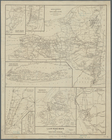
The south part of Virginia, now the north part of Carolina
0
Atlases, gazetteers, guidebooks and other books
377
Maps of the World
16
Maps of the Oceans
24
Maps of North and South America
23
Maps of North America.
551
Maps of New York City and State
1340
Lawrence H. Slaughter Collection of English maps, charts, globes, books and atlases
1020
John H. Levine Collection
60
More
Show filters
Hide filters
Show Only Public Domain
topic
Railroads
127
Real property
89
Administrative and political divisions
62
Local transit
59
Landowners
53
More
Less
name
Rand McNally and Company
23
Dripps, M. (Matthew)
18
C.S. Hammond & Company
13
Welcke, Robert A
13
G.W. & C.B. Colton & Co
11
More
Less
collection
Maps of New York City and State
360
Atlases, gazetteers, guidebooks and other books
1
Lawrence H. Slaughter Collection of English maps, charts, globes, books and atlases
1
place
x
New York
New York (State)
362
New York (N.Y.)
155
Brooklyn (New York, N.Y.)
134
Manhattan (New York, N.Y.)
105
More
Less
genre
Maps
362
Cadastral maps
25
Manuscript maps
18
Topographic maps
6
Mass transit
5
More
Less
publisher
The Company
17
publisher not identified
17
G.W. & C.B. Colton & Co
13
M. Dripps
13
publisher unknown
9
More
Less
division
Map Division
360
Manuscripts and Archives Division
2
type
cartographic
361
text
4
still image
1
Date Range
to
362 results found for:
x
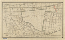
North Hempstead (N.Y. : Town) -- Maps?tab=filter
Filtering on:
x
Place
: New York
Sort by:
Relevance
Title
Date created
Date digitized
Sequence
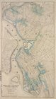
L.A.W. road
maps
of New York Division
note:
….,
N.Y
.
Various plans and draughts of cities,
towns
note:
Copy in
Map
Div. 97-6185 hand col.
m
Topographical
map
of New York City, County
note:
… in Manhattan, New York (
N.Y
Map
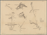
of watershed of Ramapo River
note:
Mapping
the Nation (NEH grant, 2015-2018)…
Plate I.
Map
abstract:
… with
north
toward the upper
… Center, and
North
Salem]
abstract:
… with
north
toward the upper
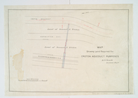
Map
showing land required for Croton
note:
… Croton Aqueduct and
N.Y
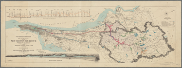
Map
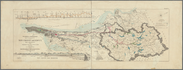
of the route of the new Croton Aqueduct
note:
… York,
N.Y
Map
of the route of the new Croton Aqueduct
note:
… York,
N.Y
Map
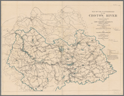
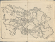
of water shed of Housatonic, Croton, Bronx
note:
Oriented with
north
to the upper left.
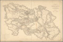
Topographical
map
showing the entire water
note:
Mapping
the Nation (NEH grant, 2015-2018)…
Topographical
map
showing the entire water
note:
Mapping
the Nation (NEH grant, 2015-2018)…
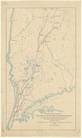
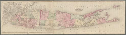
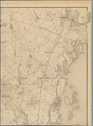
Map
of Long Island
note:
… Vesey St.
N.Y
."…
m
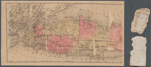
Colton's new
map
of Long Island
note:
Mapping
the Nation (NEH grant, 2015-2018)…
… situations of the
towns
note:
…. Albany,
N.Y
. 1883.
m
Map
of Long Island
note:
Shows counties, cities and
towns
, roads
Map
of Long Island
note:
….,
N.Y
.
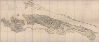
Vingboons
map
of Manhattan, 1639
note:
Oriented with
north
to the right.
m
… manuscript
map
of New York
m
Map
showing the high and low water mark
note:
…
map
. Covers Manhattan, New York (
N.Y
.) south
m
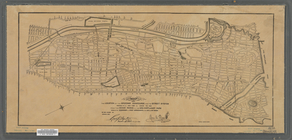
General
map
of the city of New York
note:
Note mounted on
map
: The original of this
map
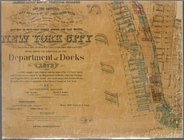
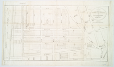
Industrial
map
of New York City
note:
Includes inset continuation
map
of Richmond
m
Map
of the northern portion of the City of New
abstract:
Cadastral
map
Map
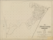
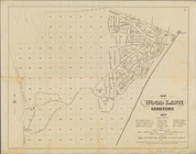
of the Wood Lawn Cemetery, 1874
Map
of the Wood Lawn Cemetery, 1877
m
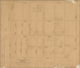
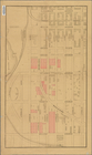
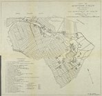
Map
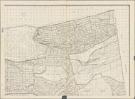
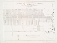
of the 23rd ward, New York City
note:
… catalog of the
Map
m
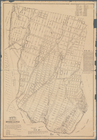
Map
of upper New York City and adjacent
note:
NYPL
Map
Div. copy is missing southwest sheet.
Map
of John W. Decker's houses and lots
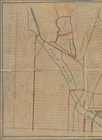
abstract:
…. Oriented with
north
m
Map
showing steam, cable, and horse roads
m
Map
or plan showing the street system
abstract:
… with
north
at upper right.
Map
showing the location of the speedway
abstract:
Map
is bound
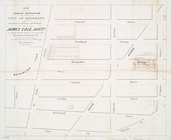
Bronx plat
map
, Alexander to Willow Avenues
Map
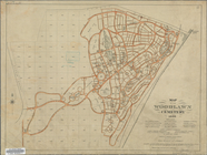
of the Woodlawn Cemetery
Map
or plan of section 10 [Crotona Park]
abstract:
… with
north
at upper right
m
Map
or plan of streets, roads, avenues
note:
… with
north
at upper right
m
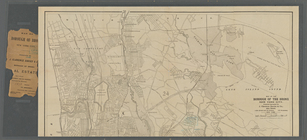
City of New York,
map
of the borough
abstract:
… with
north
to the right.
m
Map
of the borough of the Bronx, New York City
m
Map
or plan showing a general design
note:
… catalog of the
Map
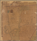
Map
of the
town
of Morrisania
note:
Survey
map
showing block dimensions, street
m
Map
of the
town
of Morrisania, Westchester Co.
N
note:
Cadastral
map
showing wards, buildings
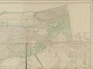
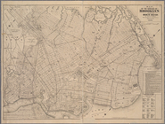
Map
of the 23rd and 24th wards of the City
note:
Oriented with
north
to the upper left of sheet.
Map
of 285 sections of ground at Flatbush, L.I
note:
… to Early
Maps
of the Middle
Map
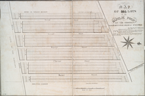
of 995 lots of the Rapelje propy
note:
… to Early
Maps
of the Middle
…, Kings County,
N
.
Y
note:
… to Early
Maps
of the Middle
Map
of property on Brooklyn Heights, or
note:
… to Early
Maps
of the Middle
m
Map
of the city of Brooklyn, as laid out
note:
… to Early
Maps
of the Middle
… at the Merchants' Exchange,
N
.
Y
.
note:
… to Early
Maps
of the Middle
Map
showing the original high and low
Map
of Newtown Creek and vicinity
note:
Extracted from: Brooklyn (New York,
N.Y
Map
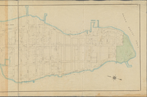
of the borough of Brooklyn published
1
2
Previous
Next
1
2
Previous
Next