Click to visit the main New York Public Library Homepage
The New York Public Library
Digital Collections
About Digital Collections
Browse
Search only public domain materials
Items
Collections
Divisions
Home
Search
Browse
About
Search only public domain materials
Items
Collections
Divisions
Digital Collections
Using Images
Using Data
Search
Keyword search
Show filters
Hide filters
Show Only Public Domain
topic
Real property
486
Administrative and political divisions
245
Railroads
238
Landowners
128
History
87
More
Less
name
E. Belcher Hyde Map Company
265
E.B. Hyde & Co
265
Ullitz, Hugo
265
United States. Farm Security Administration
89
New York (N.Y.). Board of Estimate and Apportionment
81
More
Less
collection
Maps of North America
725
Maps of New York City and State
564
Atlases of New York City
454
Farm Security Administration Photographs
88
Atlases of the United States
87
More
Less
place
New York (State)
868
New York
563
New York (N.Y.)
390
Brooklyn (New York, N.Y.)
372
Maps
344
More
Less
genre
Maps
1960
Photographs
146
Cadastral maps
121
Prints
120
Atlases
85
More
Less
publisher
E. Belcher Hyde
269
publisher not identified
90
New York (N.Y.). Board of Estimate and Apportionment
38
M.B. Brown Printing & Binding Co.,
37
New York (N.Y.). Dept. of City Planning
37
More
Less
division
Map Division
1964
Wallach Division: Photography Collection
107
Wallach Division: Picture Collection
41
General Research Division
40
Billy Rose Theatre Division
35
More
Less
type
cartographic
1962
still image
384
text
89
moving image
7
sound recording
6
More
Less
Date Range
to
2,373 results found for:
Scales
Sort by:
Relevance
Title
Date created
Date digitized
Sequence
Results 251 - 300
m
Street guide of Manhattan and…
note:
….] (
scale
1:18,000).
Map of portion of greater New…
note:
Scale
not given (W 74°03ʹ21ʺ--W 73°50ʹ54ʺ/N
m
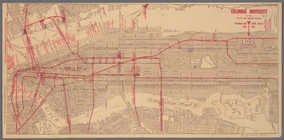
Columbia University in the Ci…
note:
Scale
not given (W 74°01ʹ19ʺ--W 73°55ʹ11ʺ/N
Map of the borough of Manhatt…
note:
Scale
not given (W 74°01ʹ05ʺ--W 73°46ʹ11ʺ/N
Greater New York's Census dis…
note:
Scale
not given (W 74°01ʹ22ʺ--W 73°46ʹ30ʺ/N
m
Map of the City of New York a…
note:
Scale
1:30,600 (W 74°17ʹ19ʺ--W 73°41ʹ19ʺ/N
Map of New York City and vici…
note:
Scale
approximately 1:120,000. (W 74°18ʹ48ʺ--W
m
Rand McNally commercial map o…
note:
Scale
1:7,200; 600 feet = 1 inch (W 74°02ʹ…
m
Watson's new map of New York,…
note:
Scale
not given. (W 74°03ʹ13ʺ--W 73°57ʹ36ʺ/N
m
Hudson River vehicular tunnel…
note:
Scales
not given.
Hagstrom's map of ... New Yor…
note:
Scale
approximately 1:16,800.
m
Vicinity of New York
note:
Scale
approximately 1:275,000. (W 74°23ʹ47ʺ--W
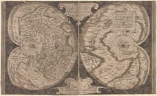
World map on double cordiform…
note:
Scale
[ca. 1:65,000,000] ; Cordiform
Map of Morningside Park
note:
Scale
approximately 1:1,250.
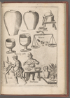
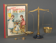
M. Bortolomeo [sic] Scappi De…
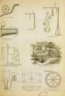
topic:
Scales
(Weighing instruments)…
Lighting plot: boom details
note:
Scale
: 1/2"=1.0'…
Cross section drawing 2
note:
scale
: 1/2"=1.0'…
Preliminary light plot
note:
scale
: 1/2"=1.0'…
m
Scale
at elevator. Grundy Center, Iowa
m
Map of original grants and fa…
note:
Scale
not given.
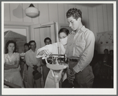
m
…. Patient on
scale
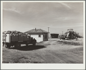
m
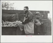
Farmer's truck driving into
scale
house
m
The Flowering of Plants, acci…
note:
Large
scale
with tabulated observations
m
A map shewing the extent of t…
note:
Scale
not given (W 74°01ʹ12ʺ--W 74°00ʹ00ʺ/N
m
Reynolds' map of modern Londo…
note:
Scale
1:18,000
m
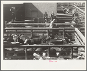
Cattle near the
scale
house, stockyards
…, on a larger
scale
; sculptures
…; ancient
scales
; hydraulic
m
… to
scales
, cornhusking
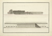
Coupe et elevation du museum …
collection:
… at a
scale
twice
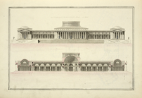
Coupe et elevation du palais …
collection:
…
scale
as the plan.
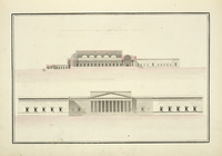
Coupe et elevation du palais …
collection:
…
scale
as the plan.
Cooking game with metal
scales
Official map of Michigan : ra…
note:
Scale
1:633,600. 10 miles to one inch (W
m
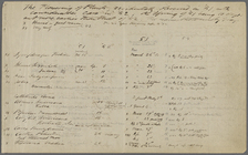
Silas Dickinson's book
Minbars, standards, and
scales
m
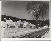
House and barns of large-
scale
dairy farm
m
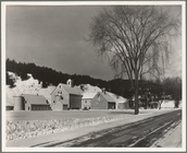
House and barns of large-
scale
dairy farm
Colton's railroad & township …
note:
Scale
approximately 1:975,000 ( (W 80°11ʹ--W
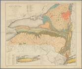
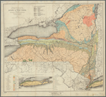
Economic and geologic map of …
note:
Scale
approximately 1:900,000 (W 79°50ʹ--W 73°00
Preliminary geologic map of A…
note:
Scale
1:63,360. 1 inch = 1 mile (W 74°15
m
Map of Long Island and the so…
note:
Scale
approximately 1:158,400, 2 1/2 miles
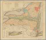
Economic and geologic map of …
note:
Scale
approximately 1:900,000 (W 79°46ʹ--W 71°52
Map of the state of New York:…
note:
Scale
not given (W 80°30ʹ--W 71°47ʹ/N 45°58
Map of the rail roads of the …
note:
Scale
not given (W 80°20ʹ--W 71°20ʹ/N 45°42
Economic and geologic map of …
note:
Scale
approximately 1:900,000 (W 79°45ʹ--W 71°47
m
Map of the southern part of W…
note:
Scale
approximately 12,700 (W 73°56ʹ--W 73°42
m
Map of Ulster County, New York
note:
Scale
approximately 1:63,360 (W 74°46ʹ--W 73°54
Map of the rail-roads of the …
note:
Scale
not given (W 80°12ʹ--W 71°47ʹ/N 45°44
Map of the rail roads of the …
note:
Scale
approximately 1:1,000,000 (W 80°20ʹ--W 71°20
1
2
3
4
5
6
7
8
9
10
Previous
Next
1
2
3
4
5
6
7
8
9
10
Previous
Next