Click to visit the main New York Public Library Homepage
The New York Public Library
Digital Collections
About Digital Collections
Browse
Search only public domain materials
Items
Collections
Divisions
Home
Search
Browse
About
Search only public domain materials
Items
Collections
Divisions
Digital Collections
Using Images
Using Data
Search
Keyword search
Show filters
Hide filters
Show Only Public Domain
topic
Real property
486
Administrative and political divisions
245
Railroads
238
Landowners
128
History
87
More
Less
name
E. Belcher Hyde Map Company
265
E.B. Hyde & Co
265
Ullitz, Hugo
265
United States. Farm Security Administration
89
New York (N.Y.). Board of Estimate and Apportionment
81
More
Less
collection
Maps of North America
725
Maps of New York City and State
564
Atlases of New York City
454
Farm Security Administration Photographs
88
Atlases of the United States
87
More
Less
place
New York (State)
868
New York
563
New York (N.Y.)
390
Brooklyn (New York, N.Y.)
372
Maps
344
More
Less
genre
Maps
1960
Photographs
146
Cadastral maps
121
Prints
120
Atlases
85
More
Less
publisher
E. Belcher Hyde
269
publisher not identified
90
New York (N.Y.). Board of Estimate and Apportionment
38
M.B. Brown Printing & Binding Co.,
37
New York (N.Y.). Dept. of City Planning
37
More
Less
division
Map Division
1964
Wallach Division: Photography Collection
107
Wallach Division: Picture Collection
41
General Research Division
40
Billy Rose Theatre Division
35
More
Less
type
cartographic
1962
still image
384
text
89
moving image
7
sound recording
6
More
Less
Date Range
to
2,373 results found for:
Scales
Sort by:
Relevance
Title
Date created
Date digitized
Sequence
Results 2001 - 2050
m
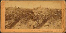
… succeded in
Scaling
, Battle
m
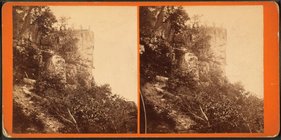
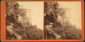
Roper's Rock, where Troops
scaled
the cliffs.
m
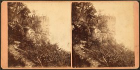
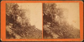
Roper's Rock, where Troops
scaled
the cliffs.
m
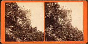
Roper's Rock, where Troops
scaled
the cliffs.
m
Roper's Rock, where Troops
scaled
the cliffs.
m
Roper's Rock, where Troops
scaled
the cliffs.
Paper Money
abstract:
… the Massachusetts
scale
). Engraved
m
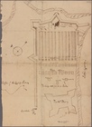
Plan
note:
….
Scale
: none given
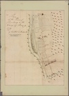
Plan
note:
….
Scale
: none given
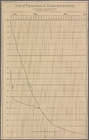
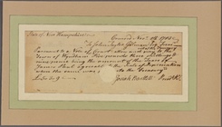
Document
abstract:
… to the
scale
of depreciation
m
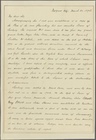
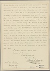
Letter to General --
abstract:
… on a
scale
of depreciation
m
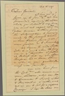
Letter to Benjamin Harrison, …
abstract:
… in the American
scale
, and North
m
Letter to K[illian] K. Van Re…
abstract:
… influence into the
scale
m
Letter to M[atthias] B[urnet]…
abstract:
… the
scale
for or against his
Plan
note:
Size: 11 x 15 in.
Scale
: 100 feet
Plan
note:
Size: 12 x 9 1/2 in.
Scale
: not given
Map
note:
Size: 11 5/8 x 11 1/8 inches.
Scale
: 2
Plan
note:
Size: 14 x 11 inches.
Scale
: not given
Map of the water frontage of …
note:
Scale
not given.
Novi Belgii: Tabula ad N. J. …
note:
Scale
ca. 1:2,200,000.
Information map of part of Ge…
note:
Scale
[1:31,680]. 2 in. to 1 mile (W
Map of Loudon [sic], Jefferso…
note:
Scale
approximately 1:120,000 (W 78°08ʹ46ʺ--W
Part of Paulding County, Geor…
note:
Scale
1:31,680. 2 inches to 1 mile (W 84°53
Part of Paulding County, Geor…
note:
Scale
approximately 1:31,680 (W 84°53ʹ--W 84°44
Part of Cobb Co., Ga
note:
Scale
1:63,360. 1 in. to one mile (W
Henrico County, Virginia: pre…
note:
Scale
approximately 1:75,000 (W 77°42ʹ46ʺ--W
Map of the battle field of Ge…
note:
Scale
approximately 1:63,360 (W 77°15ʹ50ʺ--W
The United States according t…
note:
Scale
[ca. 1:3,200,000] (W 95°--W 59°/N
m
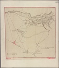
Sketch of the battle of Frede…
note:
Scale
approximately 1:44,000 (W 77°31ʹ57ʺ--W
A new map of Maryland and Del…
note:
Inset map: Baltimore [
scale
ca
An actual survey of the sea c…
note:
…] Royal, on a larger
scale
Virginiae partis australis, e…
note:
Bar
scale
above the neat line on the lower
Virginiae partis australis, e…
note:
Bar
scale
above the neat line on the lower
Virginiae partis australis, e…
note:
Bar
scale
above the neat line on the lower
Carte des Etats-unis : provin…
note:
Scale
[ca. 1:2,400,000] (W 101⁰--W 66⁰/N
… other, with a
scale
Skeleton map showing the rail…
note:
… small-
scale
government maps
New & accurate map of North A…
note:
Scale
[ca. 1:40,000,000].
An accurate map of North Amer…
note:
Scale
[ca. 1:45,000,000] (W 140⁰--W 0⁰/N
Philadelphia
note:
Scale
[ca. 1:18,000].
A Map of the United States of…
note:
Scale
[ca. 1:4,400,000] (W 95⁰--W 65⁰/N
Complete railway map designed…
note:
… on an enlarged
scale
.
Amerique septentrionale divis…
note:
In upper right corner below
scale
m
Lay's map of the United States
note:
Scale
[ca. 1:2,000,000] (W 97⁰--W 67⁰/N
Carte de la Nouvelle France :…
abstract:
… in dimensions,
scale
, note about
Carte de la Nouvelle France, …
abstract:
…,
scale
, lack of note
The Philadelphia visiter's [s…
note:
….
Scale
[1:24,000]. 1 map
Map showing the lands assigne…
note:
Scale
[1:2,534,400]. 40 miles = 1 in. (W
Map of the U. S. and Territor…
note:
Inset: Territory of Alaska.
Scale
[ca
Map of the U. S. and Territor…
note:
Inset: Territory of Alaska.
Scale
[ca
1
2
3
4
5
6
7
8
9
10
Previous
Next
1
2
3
4
5
6
7
8
9
10
Previous
Next