Click to visit the main New York Public Library Homepage
The New York Public Library
Digital Collections
About Digital Collections
Browse
Search only public domain materials
Items
Collections
Divisions
Home
Search
Browse
About
Search only public domain materials
Items
Collections
Divisions
Digital Collections
Using Images
Using Data
Search
Filtered search
Show filters
Hide filters
Show Only Public Domain
topic
Real property
1049
Landowners
346
Administrative and political divisions
342
Railroads
259
Nautical charts
230
More
Less
name
Perris, William
308
United States Coast Survey
255
Bache, A. D. (Alexander Dallas), 1806-1867
205
Beers, F. W. (Frederick W.)
176
Burr, David H., 1803-1875
142
More
Less
collection
Maps of North America
1361
Maps of New York City and State
742
Atlases of the United States
637
Atlases of New York City
532
Lawrence H. Slaughter Collection of English maps, charts, globes, books and atlases
114
More
Less
place
New York (State)
1301
New York
529
Manhattan (New York, N.Y.)
418
United States
342
New York (N.Y.)
340
More
Less
genre
Maps
3715
Atlases
611
Cadastral maps
298
Nautical charts
189
Prints
158
More
Less
publisher
publisher not identified
244
William Perris
142
U.S. Coast Survey
128
Perris & Browne
124
Chapman and Hall
109
More
Less
division
Map Division
3401
General Research Division
129
George Arents Collection
52
Rare Book Division
38
Schomburg Manuscripts, Archives and Rare Books Division
20
More
Less
type
x
cartographic
still image
116
text
105
Date Range
to
3,814 results found
Filtering on:
x
Date
: 1830 - 1870
x
Type
: cartographic
Sort by:
Title
Date created
Date digitized
Sequence
Results 1751 - 1800
Map of field of occupation, A…
Map showing the approaches to…
Frederick County Maryland: pr…
Yorktown, armament of batteri…
Map shewing position of 1st B…
Information map, Hd. Qrs. 20 …
Information map, Hd. Qrs, 20t…
Manuscript map of northwester…
Part of Cobb Co., Ga
Information map of part of Ge…
Map of Virginia, Fredericksbu…
m
The position of Yorktown with…
Profiles of enemy's works, Po…
Map exhibiting the approaches…
Part of Cobb County, Georgia
Map no. 16, Battlefield of Fo…
Map of first district, Campbe…
Part of northern Georgia
Part of northern Georgia: no.…
Part of northern Georgia: no.…
Plan of the town of Newton in…
Map no. 12, Port Hudson and v…
The cities of Pittsburgh and …
Map of the lower village of M…
Map of Kings and part of Quee…
Coast chart from Cape Hattera…
Chart of the coast of Califor…
The coast of the United State…
Squire's map of the state of …
Distance map of the state of …
Map of the country thirty thr…
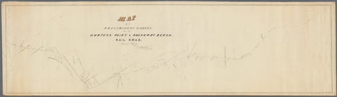
Map of a preliminary survey f…
m
New map of that portion of No…
Map of the western and middle…
Colton's new illustrated & em…
Map of North America
Americæ septentrionalis pars:…
Americae septentrionalis pars…
m
Dec. 13th Positions of Humphr…
Map of field of occupation of…
m
Vicinity of the Rapidan and R…
Yorktown, armament of batteri…
m
Position Army Cumbld., June 2…
Information map only, H. Qrs.…
Manuscript map of Civil War t…
Manuscript map of a small are…
Information map: [northwester…
Manuscript map of the area we…
Manuscript map of a military …
Manuscript map of an approxim…
1
2
…
5
6
7
8
9
10
11
12
…
15
16
Previous
Next
1
2
…
5
6
7
8
9
10
11
12
…
15
16
Previous
Next