Click to visit the main New York Public Library Homepage
The New York Public Library
Digital Collections
About Digital Collections
Browse
Search only public domain materials
Items
Collections
Divisions
Home
Search
Browse
About
Search only public domain materials
Items
Collections
Divisions
Digital Collections
Using Images
Using Data
Search
Filtered search
Show filters
Hide filters
Show Only Public Domain
topic
Real property
1049
Landowners
346
Administrative and political divisions
342
Railroads
259
Nautical charts
230
More
Less
name
Perris, William
308
United States Coast Survey
255
Bache, A. D. (Alexander Dallas), 1806-1867
205
Beers, F. W. (Frederick W.)
176
Burr, David H., 1803-1875
142
More
Less
collection
Maps of North America
1361
Maps of New York City and State
742
Atlases of the United States
637
Atlases of New York City
532
Lawrence H. Slaughter Collection of English maps, charts, globes, books and atlases
114
More
Less
place
New York (State)
1301
New York
529
Manhattan (New York, N.Y.)
418
United States
342
New York (N.Y.)
340
More
Less
genre
Maps
3715
Atlases
611
Cadastral maps
298
Nautical charts
189
Prints
158
More
Less
publisher
publisher not identified
244
William Perris
142
U.S. Coast Survey
128
Perris & Browne
124
Chapman and Hall
109
More
Less
division
Map Division
3401
General Research Division
129
George Arents Collection
52
Rare Book Division
38
Schomburg Manuscripts, Archives and Rare Books Division
20
More
Less
type
x
cartographic
still image
116
text
105
Date Range
to
3,814 results found
Filtering on:
x
Date
: 1830 - 1870
x
Type
: cartographic
Sort by:
Title
Date created
Date digitized
Sequence
Results 1001 - 1050
Sketch of Ocracoke Inlet, Nor…
Map of the states of North & …
North and South Carolina
Plan of the old fort at Dorch…
Réduction à la meme échelle d…
Carte de l'Arabie Pétrée levé…
Carte de l'Arabie Pétrée indi…
Map of the seat of war in Flo…
m
Map of the state of Georgia: …
m
Bonner's pocket map of the st…
Brattleboro and vicinity : co…
Georgia and Alabama
Atlantic and Gulf Coast Canal…
The tourist's pocket map of t…
Johnson's Delaware and Maryla…
Map of the state of Vermont
The Delaware River from the F…
Tidal currents of Long Island…
Map of New Netherland with a …
m
Map of Genesee County, New Yo…
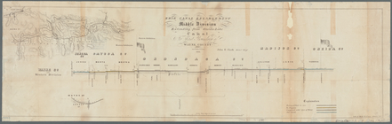
Erie Canal enlargement, middl…
A map of part of the land in …
Map of Long Island: showing t…
Albemarle and Chesapeake Cana…
Map of the Parish of Winn, Lo…
m
Map of Kentucky & Tennessee :…
Sketch of the Pontchartrain H…
City of Apalachicola and its …
m
Lands in the State of North C…
Lloyd's official map of the S…
Reconnaissance of Port Royal …
Preliminary chart of Winyah B…
Stono Inlet, South Carolina
Charleston harbor : showing t…
Preliminary chart of Ossabaw …
Reconnaissance of Doboy Bar a…
Reconnaissance of Doboy Bar a…
Map showing route of marches …
Noua Terrae-Mariae tabula
Map of the South Western dist…
County and railroad map of th…
Colton's Georgia
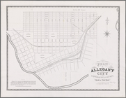
Plan of Allegany City in Catt…
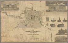
Map of the village of Auburn
Lloyd's official map of the s…
Lloyd's official map of the S…
Preliminary Chart of Atchafal…
Passe A Loutre, Mississippi D…
St. Louis Bay and Shieldsboro…
Chart of a part of the Gulf o…
1
2
3
4
5
6
7
8
9
10
…
15
16
Previous
Next
1
2
3
4
5
6
7
8
9
10
…
15
16
Previous
Next