Click to visit the main New York Public Library Homepage
The New York Public Library
Digital Collections
About Digital Collections
Browse
Search only public domain materials
Items
Collections
Divisions
Home
Search
Browse
About
Search only public domain materials
Items
Collections
Divisions
Digital Collections
Using Images
Using Data
Search
Filtered search
Show filters
Hide filters
Show Only Public Domain
topic
Real property
1049
Landowners
346
Administrative and political divisions
342
Railroads
259
Nautical charts
230
More
Less
name
Perris, William
308
United States Coast Survey
255
Bache, A. D. (Alexander Dallas), 1806-1867
205
Beers, F. W. (Frederick W.)
176
Burr, David H., 1803-1875
142
More
Less
collection
Maps of North America
1361
Maps of New York City and State
742
Atlases of the United States
637
Atlases of New York City
532
Lawrence H. Slaughter Collection of English maps, charts, globes, books and atlases
114
More
Less
place
New York (State)
1301
New York
529
Manhattan (New York, N.Y.)
418
United States
342
New York (N.Y.)
340
More
Less
genre
Maps
3715
Atlases
611
Cadastral maps
298
Nautical charts
189
Prints
158
More
Less
publisher
publisher not identified
244
William Perris
142
U.S. Coast Survey
128
Perris & Browne
124
Chapman and Hall
109
More
Less
division
Map Division
3401
General Research Division
129
George Arents Collection
52
Rare Book Division
38
Schomburg Manuscripts, Archives and Rare Books Division
20
More
Less
type
x
cartographic
still image
116
text
105
Date Range
to
3,814 results found
Filtering on:
x
Date
: 1830 - 1870
x
Type
: cartographic
Sort by:
Title
Date created
Date digitized
Sequence
Results 751 - 800
Illinois & Missouri
Sketch showing route of gener…
A carefully prepared map of t…
This plan of the city of Balt…
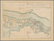
Attacks of Fort Washington by…
Map of the states of Missouri…
Military map of Nebraska and …
Military map of Nebraska and …
Map of Pacific Railroad Free …
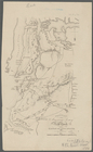
Fragment of a map, covering p…
Map of lands belonging to Jam…
Rappahannock River, Virginia …
Preliminary chart of Rappahan…
Preliminary chart of Rappahan…
Preliminary chart of Rappahan…
Rappahannock River, Virginia …
Metomkin Inlet, Virginia : fr…
Map of Virginia, Maryland, De…
Patapsco River and the approa…
Hydrographic reconnaissance o…
Map of the Clinton County Coa…
Central Virginia : showing Li…
Map of the battlefield of Ant…
m
Henrico Co. Virginia with add…
Map of part of Fauquier Count…
Map of York River, Virginia :…
Loudon County, Virginia
m
Territory of the United State…
Map of the town of Blackstone…
Map of the town of Fairhaven,…
Map of Gloucester, Cape Ann: …
Preliminary sketch showing th…
A sketch map of a portion of …
Map no. 2, from the northern …
Lynn Harbor, Massachusetts 18…
Historical map of Nantucket
Preliminary chart of Nantucke…
Map of the city of New Haven:…
A new map of the state of Cal…
m
Military map of Nebraska and …
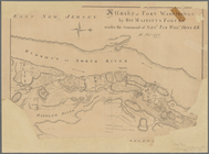
Attacks of Fort Washington by…
Map of Brooklyn at the time o…
Plan of the attack on forts C…
Operations on the Hudson River
Operations on Hudson's River
Position of the American Army…
Attack on forts Clinton and M…
Map of the proposed line of r…
Middle Virginia and North Car…
Map of Virginia, part of West…
1
2
3
4
5
6
7
8
9
10
…
15
16
Previous
Next
1
2
3
4
5
6
7
8
9
10
…
15
16
Previous
Next