Click to visit the main New York Public Library Homepage
The New York Public Library
Digital Collections
About Digital Collections
Browse
Search only public domain materials
Items
Collections
Divisions
Home
Search
Browse
About
Search only public domain materials
Items
Collections
Divisions
Digital Collections
Using Images
Using Data
Search
Filtered search
Show filters
Hide filters
Show Only Public Domain
topic
Real property
1049
Landowners
346
Administrative and political divisions
342
Railroads
259
Nautical charts
230
More
Less
name
Perris, William
308
United States Coast Survey
255
Bache, A. D. (Alexander Dallas), 1806-1867
205
Beers, F. W. (Frederick W.)
176
Burr, David H., 1803-1875
142
More
Less
collection
Maps of North America
1361
Maps of New York City and State
742
Atlases of the United States
637
Atlases of New York City
532
Lawrence H. Slaughter Collection of English maps, charts, globes, books and atlases
114
More
Less
place
New York (State)
1301
New York
529
Manhattan (New York, N.Y.)
418
United States
342
New York (N.Y.)
340
More
Less
genre
Maps
3715
Atlases
611
Cadastral maps
298
Nautical charts
189
Prints
158
More
Less
publisher
publisher not identified
244
William Perris
142
U.S. Coast Survey
128
Perris & Browne
124
Chapman and Hall
109
More
Less
division
Map Division
3401
General Research Division
129
George Arents Collection
52
Rare Book Division
38
Schomburg Manuscripts, Archives and Rare Books Division
20
More
Less
type
x
cartographic
still image
116
text
105
Date Range
to
3,814 results found
Filtering on:
x
Date
: 1830 - 1870
x
Type
: cartographic
Sort by:
Title
Date created
Date digitized
Sequence
Results 251 - 300
Topographical map of that por…
Phelps's national map of the …
m
A new map of the western rive…
Planta topografica della citt…
Rouine d'un Tempio d'Iside pr…
Pianta della città del Cairo.
Pianta topografica di alcune …
Altra veduta di Carnac; Piant…
Pianta del tempio di Luxor.
Piano generale di Tebe.
Pianta del tempio di File.
Plan of Public Garden: showin…
Map of the water region: adja…
Plan of main ship channel in …
No. III, changes in the bed o…
Sketch of the Battle of Bunke…
Skeleton map of the overland …
Plan of Charles River and War…
Map showing the New York and …
Map of Massachusetts, Vermont…
The northern route from Bosto…
Map showing route of marches …
Plan of extension of Devonshi…
Plan of extension of Devonshi…
Boston with Charlestown and R…
No. I, changes in the bed of …
Plan of South Bay: showing ch…
Map of the frontiers of the n…
Map of Boston and vicinity: e…
Plan for the occupation of th…
Le Kaire et ses environs
Plan of the Tunnel with refer…
Map of free states, slave sta…
Geognosticheskaia karta bereg…
Karta rasprostraneniia dreves…
Plan chasti goroda Aiguna
Plan Albazinskago ukrepleniia…
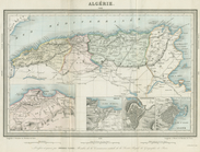
Algerie
The Nile, from Assuan to the …
General plan of the pyramids …
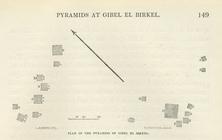
Plan of the pyramids of Gibel…
Map of the port & vicinity of…
Map of New York City showing …
A chart of the world : exhibi…
McClung's map of Minnesota : …
Map of a part of the Village …
Plan of the city of Philadelp…
Topographical map of Fairmoun…
Chengwatana, Pine County, M.T…
Map of the territory of Minne…
1
2
3
4
5
6
7
8
9
10
…
15
16
Previous
Next
1
2
3
4
5
6
7
8
9
10
…
15
16
Previous
Next