Click to visit the main New York Public Library Homepage
The New York Public Library
Digital Collections
About Digital Collections
Browse
Search only public domain materials
Items
Collections
Divisions
Home
Search
Browse
About
Search only public domain materials
Items
Collections
Divisions
Digital Collections
Using Images
Using Data
Search
Filtered keyword search
Show filters
Hide filters
Show Only Public Domain
topic
Real property
10812
Fire insurance
5289
Cities & towns
5001
Administrative and political divisions
906
Railroads
784
More
Less
name
Sanborn Map Company
5093
G.W. Bromley & Co
2471
Bromley, George Washington
797
Bromley, Walter Scott
797
Austro-Hungarian Monarchy. Militärgeographisches Institut
773
More
Less
collection
Atlases of New York City
10577
Atlases of the United States
3749
Maps of North America
3345
Maps of New York City and State
2046
Lawrence H. Slaughter Collection of English maps, charts, globes, books and atlases
1101
More
Less
place
New York (State)
12153
New York
3978
New York (N.Y.)
2423
Manhattan (New York, N.Y.)
2371
Brooklyn (New York, N.Y.)
1166
More
Less
genre
Maps
24593
Atlases
3679
Topographic maps
1062
Surveys
1032
land surveys
849
More
Less
publisher
Sanborn Map Company
5129
G.W. Bromley & Co
2294
E. Belcher Hyde
780
K.u.K. Militargeographisches Institut
773
publisher not identified
452
More
Less
division
Map Division
22270
Manuscripts and Archives Division
1079
General Research Division
400
Rare Book Division
320
Schomburg Jean Blackwell Hutson Research and Reference Division
191
More
Less
type
x
cartographic
text
647
still image
322
Date Range
to
Looking for one of these collections?
Atlases of New York City
11,722 items
Atlases of the United States
3,868 items
Maps of North America
3,345 items
Maps of New York City and State
2,059 items
Lawrence H. Slaughter Collection of English maps, charts, globes, books and atlases
1,252 items
Bancker plans
1,080 items
24,808 results found for:
x
New York Maps
Filtering on:
x
Type
: cartographic
Sort by:
Relevance
Title
Date created
Date digitized
Sequence
m
Maps
of property in the city of
New
York
use:
… partner (e.g.,
New
York
m
Nuevo mapa topográfico de la …
use:
… partner (e.g.,
New
York
Pas kaart van de zee kusten v…
use:
… partner (e.g.,
New
York
Oud-Groenland, of deszelfs Oo…
use:
… partner (e.g.,
New
York
m
Map
of the Cedar Knolls, at Bronxville
use:
… partner (e.g.,
New
York
m
Report on the work of the com…
use:
… partner (e.g.,
New
York
A
map
of Carolina, Florida and the Bahama
use:
… partner (e.g.,
New
York
Plan of the town of Paramarib…
image:
psnypl_
map
_229
A
map
of Dutch settlements of Surinam
image:
psnypl_
map
_228
Pas-kaart vande Rivieren Comm…
image:
psnypl_
map
_227
Nieuwe kaart van Suriname : v…
use:
… partner (e.g.,
New
York
Representation la plus nouvel…
image:
ps_
map
_128
A plan of the city of
New
York
from
use:
… partner (e.g.,
New
York
Carte des Isles de L'Amerique…
use:
… partner (e.g.,
New
York
Carte de L'Isle de Saint-Domi…
use:
… partner (e.g.,
New
York
m
Mapah derekh emet : Mapa Dere…
use:
… partner (e.g.,
New
York
Nette Koerswysing van Amsterd…
use:
… partner (e.g.,
New
York
De nette koers wysing van de …
use:
… partner (e.g.,
New
York
Le Ruyavme d Abyssinie ou lem…
use:
… partner (e.g.,
New
York
L"empire du Monomotapa et la …
use:
… partner (e.g.,
New
York
Isle de Malthe
use:
… partner (e.g.,
New
York
Isle de Madagascar dite de St…
use:
… partner (e.g.,
New
York
Isles dv Cap Verd
use:
… partner (e.g.,
New
York
I. Goree
use:
… partner (e.g.,
New
York
Afrique Ancienne
use:
… partner (e.g.,
New
York
Afrique Moderne
use:
… partner (e.g.,
New
York
Partie Septentrionale de L'An…
use:
… partner (e.g.,
New
York
Africae Accurata Tabula ex Of…
use:
… partner (e.g.,
New
York
Nova Aegypti Tabula
use:
… partner (e.g.,
New
York
Barbaria Biledulgered o: Liby…
use:
… partner (e.g.,
New
York
Fezzae et Marocchi Regna Afri…
use:
… partner (e.g.,
New
York
Nigritarum Regio
use:
… partner (e.g.,
New
York
Gvinea
use:
… partner (e.g.,
New
York
Aethiopia Inferior vel Exteri…
use:
… partner (e.g.,
New
York
Regna Congo et Angola
use:
… partner (e.g.,
New
York
Aethiopia Superior vel Interi…
use:
… partner (e.g.,
New
York
Insvla S. Lavrentii, vulgo Ma…
use:
… partner (e.g.,
New
York
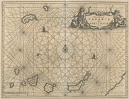
Insula Promontorii Viridis, H…
use:
… partner (e.g.,
New
York
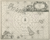
Insula Canariae alias Fortuna…
use:
… partner (e.g.,
New
York
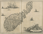
Melite Insula vulgo Masia
use:
… partner (e.g.,
New
York
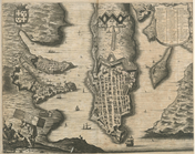
Difegno Della Citta Valletta
use:
… partner (e.g.,
New
York
Isothermal chart, or, View of…
use:
… partner (e.g.,
New
York
An old
map
of Heijokyo (Heijo Castle)…
use:
… partner (e.g.,
New
York
An old
map
of Heiankyo (Heian Castle)…
use:
… partner (e.g.,
New
York
Tabula Nautica.
use:
… partner (e.g.,
New
York
Americae Pars Borealis, Flori…
use:
… partner (e.g.,
New
York
Paris, ses monuments : guide …
image:
psnypl_
map
_302
Plan of the Central Park, City of
New
York
use:
… partner (e.g.,
New
York
Map
of Camp Chase. Drawn on a scale of 120
use:
… partner (e.g.,
New
York
Map
illustrating the operations of the U.S
use:
… partner (e.g.,
New
York
1
2
3
4
5
6
7
8
9
10
…
99
100
Previous
Next
1
2
3
4
5
6
7
8
9
10
…
99
100
Previous
Next