Click to visit the main New York Public Library Homepage
The New York Public Library
Digital Collections
About Digital Collections
Browse
Search only public domain materials
Items
Collections
Divisions
Home
Search
Browse
About
Search only public domain materials
Items
Collections
Divisions
Digital Collections
Using Images
Using Data
Search
Filtered keyword search
Show filters
Hide filters
Show Only Public Domain
topic
Real property
10812
Fire insurance
5289
Cities & towns
5001
Administrative and political divisions
906
Railroads
784
More
Less
name
Sanborn Map Company
5093
G.W. Bromley & Co
2471
Bromley, George Washington
797
Bromley, Walter Scott
797
Austro-Hungarian Monarchy. Militärgeographisches Institut
773
More
Less
collection
Atlases of New York City
10577
Atlases of the United States
3749
Maps of North America
3345
Maps of New York City and State
2046
Lawrence H. Slaughter Collection of English maps, charts, globes, books and atlases
1101
More
Less
place
New York (State)
12153
New York
3978
New York (N.Y.)
2423
Manhattan (New York, N.Y.)
2371
Brooklyn (New York, N.Y.)
1166
More
Less
genre
Maps
24593
Atlases
3679
Topographic maps
1062
Surveys
1032
land surveys
849
More
Less
publisher
Sanborn Map Company
5129
G.W. Bromley & Co
2294
E. Belcher Hyde
780
K.u.K. Militargeographisches Institut
773
publisher not identified
452
More
Less
division
Map Division
22270
Manuscripts and Archives Division
1079
General Research Division
400
Rare Book Division
320
Schomburg Jean Blackwell Hutson Research and Reference Division
191
More
Less
type
x
cartographic
text
647
still image
322
Date Range
to
Looking for one of these collections?
Atlases of New York City
11,722 items
Atlases of the United States
3,868 items
Maps of North America
3,345 items
Maps of New York City and State
2,059 items
Lawrence H. Slaughter Collection of English maps, charts, globes, books and atlases
1,252 items
Bancker plans
1,080 items
24,808 results found for:
x
New York Maps
Filtering on:
x
Type
: cartographic
Sort by:
Relevance
Title
Date created
Date digitized
Sequence
Map
of Transoxania
use:
… partner (e.g.,
New
York
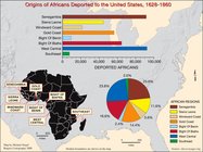
Origins of Africans deported …
collection:
… experience:
Maps
by Michael
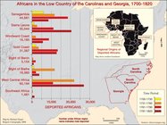
Africans in the Low Country o…
collection:
… experience:
Maps
by Michael
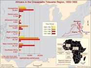
Africans in the Chesapeake Ti…
collection:
… experience:
Maps
by Michael
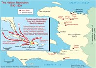
The Haitian Revolution 1793-1…
collection:
… experience:
Maps
by Michael
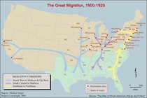
The Great Migration, 1900-1929
collection:
… experience:
Maps
by Michael
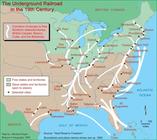
Underground Railroad 19th Cen…
collection:
… experience:
Maps
by Michael
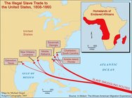
The Illegal Slave Trade to th…
collection:
… experience:
Maps
by Michael
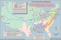
The Great Blues Migration
collection:
… experience:
Maps
by Michael
Immigrants from the Caribbean…
collection:
… experience:
Maps
by Michael
The Exodusters and Black Towns
collection:
… experience:
Maps
by Michael
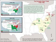
The Domestic Slave Trade 1808…
collection:
… experience:
Maps
by Michael
Largest African-American Migr…
collection:
… experience:
Maps
by Michael
Immigrants from Haiti admitte…
collection:
… experience:
Maps
by Michael
Second great migration: Afric…
collection:
… experience:
Maps
by Michael
Regional origins of enslaved …
collection:
… experience:
Maps
by Michael
Progression of the slave popu…
collection:
… experience:
Maps
by Michael
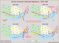
African American interstate m…
collection:
… experience:
Maps
by Michael
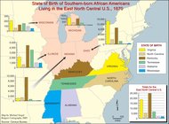
State of birth of Southern-bo…
collection:
… experience:
Maps
by Michael
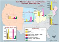
State of birth of Southern-bo…
collection:
… experience:
Maps
by Michael
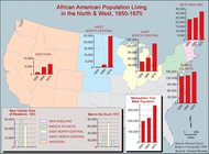
African American population l…
collection:
… experience:
Maps
by Michael
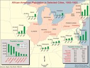
African American population i…
collection:
… experience:
Maps
by Michael
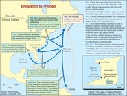
Emigration to Trinidad
collection:
… experience:
Maps
by Michael
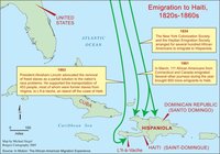
Emigration to Haiti, 1820-186…
collection:
… experience:
Maps
by Michael
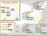
Origins of enslaved Africans …
collection:
… experience:
Maps
by Michael
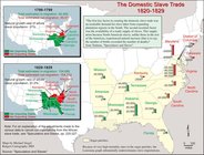
The domestic slave trade, 179…
collection:
… experience:
Maps
by Michael
The domestic slave trade, 182…
collection:
… experience:
Maps
by Michael
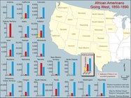
African Americans going West,…
collection:
… experience:
Maps
by Michael
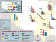
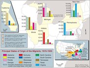
Principal states of origin of…
collection:
… experience:
Maps
by Michael
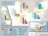
Principal states of origin of…
collection:
… experience:
Maps
by Michael
Principal states of origin of…
collection:
… experience:
Maps
by Michael
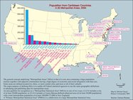
Population from Carrebean cou…
collection:
… experience:
Maps
by Michael
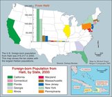
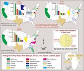
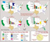
Foreign-born population from …
collection:
… experience:
Maps
by Michael
Foreign-born population from …
collection:
… experience:
Maps
by Michael
Foreign-born population from …
collection:
… experience:
Maps
by Michael
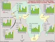
Immigrants admitted to the Un…
collection:
… experience:
Maps
by Michael
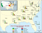
African Americans going South…
collection:
… experience:
Maps
by Michael
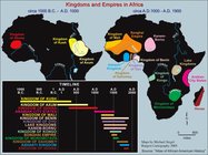
Kingdoms and Empires in Africa
collection:
… experience:
Maps
by Michael
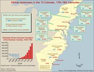
African Americans in the 13 c…
collection:
… experience:
Maps
by Michael
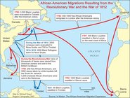
African-American migrations r…
collection:
… experience:
Maps
by Michael
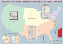
Distribution of the African A…
collection:
… experience:
Maps
by Michael
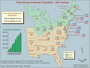
Free African American populat…
collection:
… experience:
Maps
by Michael
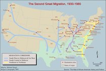
The second great migration, 1…
collection:
… experience:
Maps
by Michael
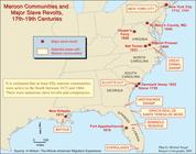
Maroon communities and major …
collection:
… experience:
Maps
by Michael
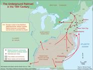
The underground railroad in t…
collection:
… experience:
Maps
by Michael
m
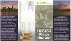
Hudson River Park, Hudson Riv…
use:
… partner (e.g.,
New
York
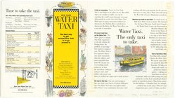
m
New
York
Water Taxi
collection:
Maps
of
New
York
City and State
Urban development of the City of
New
York
, 1625
note:
City of
New
York
, Department of City Planning
The legacy of
New
Sweden
note:
In lower left corner of
map
: Bowring
m
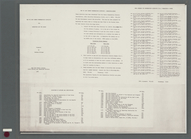
1900 census enumeration distr…
use:
… partner (e.g.,
New
York
1
2
3
4
5
6
7
8
9
10
…
99
100
Previous
Next
1
2
3
4
5
6
7
8
9
10
…
99
100
Previous
Next