Click to visit the main New York Public Library Homepage
The New York Public Library
Digital Collections
About Digital Collections
Browse
Search only public domain materials
Items
Collections
Divisions
Home
Search
Browse
About
Search only public domain materials
Items
Collections
Divisions
Digital Collections
Using Images
Using Data
Search
Keyword search
Show filters
Hide filters
Show Only Public Domain
topic
Real property
11050
Fire insurance
5305
Cities & towns
5016
City planning
1101
Social conditions
946
More
Less
name
Sanborn Map Company
5108
G.W. Bromley & Co
2551
New York (N.Y.). City Planning Commission
980
M.I.T. Press
942
Bromley, George Washington
857
More
Less
collection
Atlases of New York City
11722
Atlases of the United States
3868
Maps of North America
3345
Maps of New York City and State
2059
Lawrence H. Slaughter Collection of English maps, charts, globes, books and atlases
1252
More
Less
place
New York (State)
14041
New York
5623
New York (N.Y.)
3511
Manhattan (New York, N.Y.)
2385
Brooklyn (New York, N.Y.)
1222
More
Less
genre
Maps
25787
Atlases
3791
Prints
1428
Topographic maps
1062
Surveys
1034
More
Less
publisher
Sanborn Map Company
5145
G.W. Bromley & Co
2371
MIT Press
942
E. Belcher Hyde
807
K.u.K. Militargeographisches Institut
774
More
Less
division
Map Division
23798
Manuscripts and Archives Division
1281
Wallach Division: Print Collection
746
Rare Book Division
518
Dorot Jewish Division
477
More
Less
type
cartographic
24808
still image
3785
text
2063
notated music
10
sound recording
3
More
Less
Date Range
to
Looking for one of these collections?
Atlases of New York City
11,722 items
Atlases of the United States
3,868 items
Maps of North America
3,345 items
Maps of New York City and State
2,059 items
Lawrence H. Slaughter Collection of English maps, charts, globes, books and atlases
1,252 items
Bancker plans
1,080 items
28,779 results found for:
maps
Sort by:
Relevance
Title
Date created
Date digitized
Sequence
Results 28501 - 28550
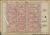
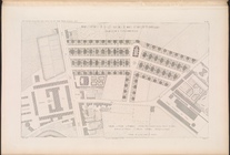
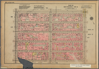
Bounded by E. 116th Street, S…
Hammond's complete
map
of New York City
Revised
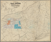
map
of the rail roads of the State
note:
Mapping
the Nation (NEH grant, 2015-2018)…
Bounded by Stanton Street, To…
Block sketch 1679, New York C…
collection:
Maps
of New York City and State
m
Hammond's complete
map
of New York City
note:
…"Based on the official
map
of the City
The Evening Mail's complete
map
and guide
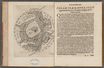
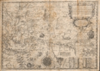
Præmatvræ solis apparitionis …
Insulae Moluccae celeberrimae…
image:
psnypl_
map
_241
Map
of the borough of Manhattan and part
image:
psnypl_
map
_255
Educational extension work of…
collection:
Maps
of New York City and State
Map
of the New York City metropolitan
Map
of the country thirty miles around New
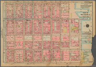
Bounded by Reade Street, Broa…
Birdseye view of greater New …
collection:
Maps
of New York City and State
m
Map
of the borough of Brooklyn, City of New York …
New York and vicinity roads a…
collection:
Maps
of New York City and State
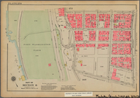
Bounded by W. 145th Street, L…
m
Map
showing 100 miles around New York
note:
…"The A.R. Ohman
Map
Co....258 Broadway
m
Metropolitan district local a…
note:
…
maps
including "Detail
m
New quick reference street indexed
map
note:
the Ohman
Map
Co.
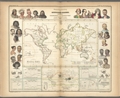
African arrivals in the Ameri…
collection:
… experience:
Maps
by Michael
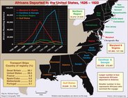
Africans deported to the Unit…
collection:
… experience:
Maps
by Michael
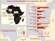
Origins of Africans deported …
collection:
… experience:
Maps
by Michael
Relief
map
of New York and vicinity
note:
…
map
.
The earliest accurate
map
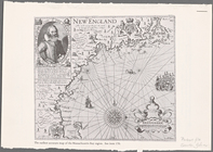
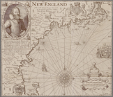
[Early
map
of the Massachusetts Bay region. Inset
Plan d'ensemble de la cité ou…
Plan d'ensemble de la cité ou…
Rail terminal facilities in G…
collection:
Maps
of New York City and State
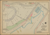
Bounded by W. 178th Street, B…
Wall St. New York City, U.S.A…
collection:
Maps
of New York City and State
Geographische Verbreitung der…
m
Cosmographey oder beschreibun…
topic:
Early
maps
m
Zambrow: Zembroṿe : zikaron …
note:
Map
on lining paper.
Hagstrom's
map
of 50 mile radius from
m
Mercator projection exhibitin…
collection:
Maps
of the Arctic Regions
Map
of New York City and vicinity …
m
Jadow
Bounded by St. Nicholas Avenu…
m
Kaluszyn (1977)
note:
One folded
map
inserted.
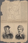
The discovery of Dr. Livingstone--
map
of equatorial
m
The John Wanamaker automobile & route
map
note:
…
maps
on verso: Motor and subway
map
boroughs
m
Sofiïvka (Volynsʹka oblastʹ):…
American Automobile Association road
map
of New
Bounded by W. 42nd Street, Ni…
m
Rand McNally official motor g…
note:
… and White Mileage
Map
, New
m
Yizker-bukh Raṭne: dos lebn …
Port of New York Authority : …
collection:
Maps
of New York City and State
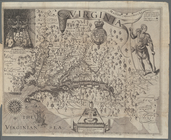
Map
of Virginia
topic:
Maps
1
2
…
106
107
108
109
110
111
112
113
114
115
116
Previous
Next
1
2
…
106
107
108
109
110
111
112
113
114
115
116
Previous
Next