Click to visit the main New York Public Library Homepage
The New York Public Library
Digital Collections
About Digital Collections
Browse
Search only public domain materials
Items
Collections
Divisions
Home
Search
Browse
About
Search only public domain materials
Items
Collections
Divisions
Digital Collections
Using Images
Using Data
Collections
Charting America: Maps from the Lawrence H. Slaughter Collection and Others
Charting America: Maps from the Lawrence H. Slaughter Collection and Others
Navigation
Filters
Charting America: Maps from the Lawrence H. Slaughter Collection and Others
Previous
The south part of Virginia, now the north part of Carolina
0
Atlases, gazetteers, guidebooks and other books
377
Maps of the World
16
Maps of the Oceans
24
Maps of North and South America
23
Maps of North America.
551
Maps of New York City and State
1340
Lawrence H. Slaughter Collection of English maps, charts, globes, books and atlases
1020
John H. Levine Collection
60
More
Show filters
Hide filters
Show Only Public Domain
topic
Administrative and political divisions
306
Real property
299
Railroads
297
Landowners
215
City planning
127
More
Less
name
New York (N.Y.). Common Council
99
Valentine, D. T. (David Thomas), 1801-1869
49
Dripps, M. (Matthew)
42
Rand McNally and Company
40
G.W. & C.B. Colton & Co
36
More
Less
collection
Maps of New York City and State
1687
Lawrence H. Slaughter Collection of English maps, charts, globes, books and atlases
153
Atlases, gazetteers, guidebooks and other books
24
Maps of North and South America
23
John H. Levine Collection
19
More
Less
place
New York (State)
1224
New York (N.Y.)
652
New York
520
Manhattan (New York, N.Y.)
347
Brooklyn (New York, N.Y.)
266
More
Less
genre
Maps
1902
Cadastral maps
183
Manuscript maps
70
Aerial views
28
Road maps
28
More
Less
publisher
publisher not identified
118
s.n
56
G.W. & C.B. Colton & Co
31
M. Dripps
29
The Company
28
More
Less
division
Map Division
1908
Manuscripts and Archives Division
2
type
cartographic
1891
text
32
still image
31
Date Range
to
1,910 results found for:
New York (N.Y.)?tab=filter
Sort by:
Relevance
Title
Date created
Date digitized
Sequence
Results 751 - 800
m
… of
New
York
use:
… partner (e.g.,
New
York
… & Dutchess,
New
York
use:
… partner (e.g.,
New
York
… territory served by the
New
York
Central and West
use:
… partner (e.g.,
New
York
Map of
New
York
I. : with the adjacent rocks and other
use:
… partner (e.g.,
New
York
…, Kings County,
N
.
Y
use:
… partner (e.g.,
New
York
Communication between Albany …
use:
… partner (e.g.,
New
York
Plan of the attack on forts C…
use:
… partner (e.g.,
New
York
m
Map of Ulster County,
New
York
use:
… partner (e.g.,
New
York
Green-wood cemetery
use:
… partner (e.g.,
New
York
Battle of Long Island
use:
… partner (e.g.,
New
York
Ports de la Nouvelle
York
et Pertamboy
use:
… partner (e.g.,
New
York
… in the town of
New
Utrecht.
use:
… partner (e.g.,
New
York
Map shewing the location of the
N
.
Y
use:
… partner (e.g.,
New
York
m
Map of the city of Brooklyn
use:
… partner (e.g.,
New
York
… of
New
York
belonging
use:
… partner (e.g.,
New
York
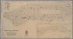
Health map of Manhattan: prep…
use:
… partner (e.g.,
New
York
… St.
New
York
use:
… partner (e.g.,
New
York
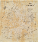
Map of Newtown, Long Island: …
use:
… partner (e.g.,
New
York
Operations after the evacuation of
New
York
, 1776
use:
… partner (e.g.,
New
York
The city of
New
York
use:
… partner (e.g.,
New
York
Map of the Catskill Mountains…
use:
… partner (e.g.,
New
York
… in the eleventh ward of
New
York
use:
… partner (e.g.,
New
York
…, at the Merchants' Exchange : [
New
York
City].
use:
… partner (e.g.,
New
York
m
Map of the enlarged city of B…
use:
… partner (e.g.,
New
York
Topographical map showing the…
use:
… partner (e.g.,
New
York
Map of the town of Niagara
use:
… partner (e.g.,
New
York
Map of the Catskill Mountains…
use:
… partner (e.g.,
New
York
Map of the Catskill Mountains…
use:
… partner (e.g.,
New
York
A map of the State of
New
York
: exhibiting
use:
… partner (e.g.,
New
York
A Plan of the City and Environs of
New
York
use:
… partner (e.g.,
New
York
Proposed site on Staten Islan…
use:
… partner (e.g.,
New
York
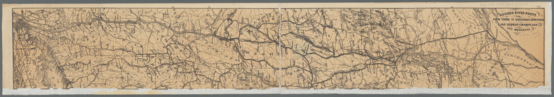
Hudson River route: New York …
use:
… partner (e.g.,
New
York
A plan of the city and environs of
New
York
use:
… partner (e.g.,
New
York
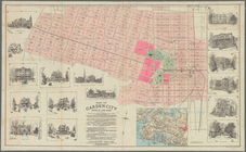
Map of Garden City, Queens Co…
use:
… partner (e.g.,
New
York
A
new
map of the city of
New
York
use:
… partner (e.g.,
New
York
… of the mountain resorts of
New
York
State and how
use:
… partner (e.g.,
New
York
Index map to Bensonhurst-by-t…
use:
… partner (e.g.,
New
York
Sketch map of the City of New…
use:
… partner (e.g.,
New
York
Battle of Long Island: from S…
use:
… partner (e.g.,
New
York
Map showing location of lands…
use:
… partner (e.g.,
New
York
New
York
und Umgebungen.
use:
… partner (e.g.,
New
York
… of the city of
New
York
use:
… partner (e.g.,
New
York
m
27th assembly district
use:
… partner (e.g.,
New
York
Sketch showing the ground und…
use:
… partner (e.g.,
New
York
Hydrographic map of the counties of
New
-
York
use:
… partner (e.g.,
New
York
m
New
map of the city of Brooklyn
use:
… partner (e.g.,
New
York
Map of the route of the
new
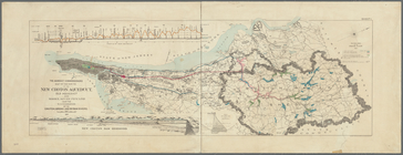
Croton Aqueduct
use:
… partner (e.g.,
New
York
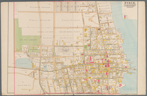
Nyack
use:
… partner (e.g.,
New
York
Karte von
New
York
use:
… partner (e.g.,
New
York
New
map of the city of
New
York
.
use:
… partner (e.g.,
New
York
1
2
3
4
5
6
7
8
Previous
Next
1
2
3
4
5
6
7
8
Previous
Next