Click to visit the main New York Public Library Homepage
The New York Public Library
Digital Collections
About Digital Collections
Browse
Search only public domain materials
Items
Collections
Divisions
Home
Search
Browse
About
Search only public domain materials
Items
Collections
Divisions
Digital Collections
Using Images
Using Data
Collections
Charting America: Maps from the Lawrence H. Slaughter Collection and Others
Charting America: Maps from the Lawrence H. Slaughter Collection and Others
Navigation
Filters
Charting America: Maps from the Lawrence H. Slaughter Collection and Others
Previous
The south part of Virginia, now the north part of Carolina
0
Atlases, gazetteers, guidebooks and other books
377
Maps of the World
16
Maps of the Oceans
24
Maps of North and South America
23
Maps of North America.
551
Maps of New York City and State
1340
Lawrence H. Slaughter Collection of English maps, charts, globes, books and atlases
1020
John H. Levine Collection
60
More
Show filters
Hide filters
Show Only Public Domain
topic
Administrative and political divisions
306
Real property
299
Railroads
297
Landowners
215
City planning
127
More
Less
name
New York (N.Y.). Common Council
99
Valentine, D. T. (David Thomas), 1801-1869
49
Dripps, M. (Matthew)
42
Rand McNally and Company
40
G.W. & C.B. Colton & Co
36
More
Less
collection
Maps of New York City and State
1687
Lawrence H. Slaughter Collection of English maps, charts, globes, books and atlases
153
Atlases, gazetteers, guidebooks and other books
24
Maps of North and South America
23
John H. Levine Collection
19
More
Less
place
New York (State)
1224
New York (N.Y.)
652
New York
520
Manhattan (New York, N.Y.)
347
Brooklyn (New York, N.Y.)
266
More
Less
genre
Maps
1902
Cadastral maps
183
Manuscript maps
70
Aerial views
28
Road maps
28
More
Less
publisher
publisher not identified
118
s.n
56
G.W. & C.B. Colton & Co
31
M. Dripps
29
The Company
28
More
Less
division
Map Division
1908
Manuscripts and Archives Division
2
type
cartographic
1891
text
32
still image
31
Date Range
to
1,910 results found for:
New York (N.Y.)?tab=filter
Sort by:
Relevance
Title
Date created
Date digitized
Sequence
Results 1501 - 1550
A map of the towns of Livings…
use:
… partner (e.g.,
New
York
… around
New
York
…
use:
… partner (e.g.,
New
York
Railroads in Manhattan, Jerse…
use:
… partner (e.g.,
New
York
m
Map of Dutchess Co.,
New
York
use:
… partner (e.g.,
New
York
Rand McNally standard map of
New
York
use:
… partner (e.g.,
New
York
New
York
and vicinity roads and rail
use:
… partner (e.g.,
New
York
m
Map of Long Island: based upo…
use:
… partner (e.g.,
New
York
The state of
New
York
from the most
use:
… partner (e.g.,
New
York
…., state of
New
York
use:
… partner (e.g.,
New
York
Map of the state of
New
York
use:
… partner (e.g.,
New
York
Plan of Oswego, 1727: (from P…
use:
… partner (e.g.,
New
York
m
Topographical map of
New
York
and vicinity …
use:
… partner (e.g.,
New
York
Newburgh,
N
.
Y
., 1878
use:
… partner (e.g.,
New
York
Plan of the city of
New
York
in North
use:
… partner (e.g.,
New
York
m
The provinces of
New
York
, and
New
use:
… partner (e.g.,
New
York
Erie Canal,
New
York
use:
… partner (e.g.,
New
York
Route of the Albany & West St…
use:
… partner (e.g.,
New
York
m
Map of the City of Utica, Oneida Co.,
N
.
Y
.
use:
… partner (e.g.,
New
York
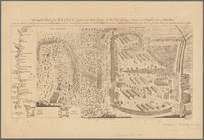
Plan of the position which th…
use:
… partner (e.g.,
New
York
Map of the River Niagara and …
use:
… partner (e.g.,
New
York
Map of Schuylerville: exhibit…
use:
… partner (e.g.,
New
York
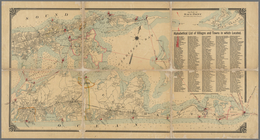
Map of all points of interest…
use:
… partner (e.g.,
New
York
… of
New
York
use:
… partner (e.g.,
New
York
…
New
York
…
use:
… partner (e.g.,
New
York
Map of the state of
New
-
York
showing its
use:
… partner (e.g.,
New
York
Map of the flats above Albany
use:
… partner (e.g.,
New
York
The Courier Company's map of …
use:
… partner (e.g.,
New
York
m
The surroundings of
New
York
City …
use:
… partner (e.g.,
New
York
Map of lands in the town of Y…
use:
… partner (e.g.,
New
York
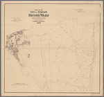
Map of lots in the 5th ward o…
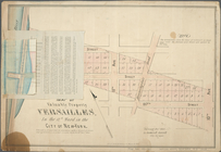
use:
… partner (e.g.,
New
York
m
Map of Geneva, Ontario Co.,
N
.
Y
.
use:
… partner (e.g.,
New
York
Map of the city of Yonkers, F…
use:
… partner (e.g.,
New
York
m
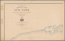
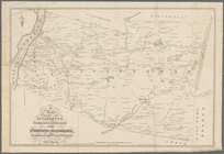
Preliminary geologic map of
New
York
use:
… partner (e.g.,
New
York
… of the city and county of
New
-
York
, and the adjacent
use:
… partner (e.g.,
New
York
m
The city of
New
York
use:
… partner (e.g.,
New
York
Rand, McNally & Co.'s indexed…
use:
… partner (e.g.,
New
York
Paterson,
N
.J. -
N
.
Y
., ed. of Feb. 1903
use:
… partner (e.g.,
New
York
m
… of
New
-
York
use:
… partner (e.g.,
New
York
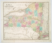
Map of the state of
New
York
: with parts
use:
… partner (e.g.,
New
York
… of
New
York
called Macomb
use:
… partner (e.g.,
New
York
Map of Ogdensburgh
use:
… partner (e.g.,
New
York
Traveller's map of Long Islan…
use:
… partner (e.g.,
New
York
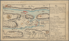
Plan der Attaque, welche Sr. …
use:
… partner (e.g.,
New
York
Map of the city of Yonkers, S…
use:
… partner (e.g.,
New
York
Map of the city of Yonkers, T…
use:
… partner (e.g.,
New
York
A prospective view of the bat…
use:
… partner (e.g.,
New
York
m
New
York
und Umgegend …
use:
… partner (e.g.,
New
York
m
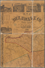
Map of Delaware Co.,
New
York
use:
… partner (e.g.,
New
York
m
Freight map of the metropolit…
use:
… partner (e.g.,
New
York
… the province of
New
York
use:
… partner (e.g.,
New
York
1
2
3
4
5
6
7
8
Previous
Next
1
2
3
4
5
6
7
8
Previous
Next