Click to visit the main New York Public Library Homepage
The New York Public Library
Digital Collections
About Digital Collections
Browse
Search only public domain materials
Items
Collections
Divisions
Home
Search
Browse
About
Search only public domain materials
Items
Collections
Divisions
Digital Collections
Using Images
Using Data
Collections
Charting America: Maps from the Lawrence H. Slaughter Collection and Others
Charting America: Maps from the Lawrence H. Slaughter Collection and Others
Navigation
Filters
Charting America: Maps from the Lawrence H. Slaughter Collection and Others
Previous
The south part of Virginia, now the north part of Carolina
0
Atlases, gazetteers, guidebooks and other books
377
Maps of the World
16
Maps of the Oceans
24
Maps of North and South America
23
Maps of North America.
551
Maps of New York City and State
1340
Lawrence H. Slaughter Collection of English maps, charts, globes, books and atlases
1020
John H. Levine Collection
60
More
Show filters
Hide filters
Show Only Public Domain
topic
Administrative and political divisions
306
Real property
299
Railroads
297
Landowners
215
City planning
127
More
Less
name
New York (N.Y.). Common Council
99
Valentine, D. T. (David Thomas), 1801-1869
49
Dripps, M. (Matthew)
42
Rand McNally and Company
40
G.W. & C.B. Colton & Co
36
More
Less
collection
Maps of New York City and State
1687
Lawrence H. Slaughter Collection of English maps, charts, globes, books and atlases
153
Atlases, gazetteers, guidebooks and other books
24
Maps of North and South America
23
John H. Levine Collection
19
More
Less
place
New York (State)
1224
New York (N.Y.)
652
New York
520
Manhattan (New York, N.Y.)
347
Brooklyn (New York, N.Y.)
266
More
Less
genre
Maps
1902
Cadastral maps
183
Manuscript maps
70
Aerial views
28
Road maps
28
More
Less
publisher
publisher not identified
118
s.n
56
G.W. & C.B. Colton & Co
31
M. Dripps
29
The Company
28
More
Less
division
Map Division
1908
Manuscripts and Archives Division
2
type
cartographic
1891
text
32
still image
31
Date Range
to
1,910 results found for:
New York (N.Y.)?tab=filter
Sort by:
Relevance
Title
Date created
Date digitized
Sequence
Results 1751 - 1800
The course of the River St. L…
use:
… partner (e.g.,
New
York
The world, on Mercator's proj…
use:
… partner (e.g.,
New
York
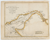
A chart of Delaware Bay and R…
use:
… partner (e.g.,
New
York
A chart of Delaware Bay and R…
use:
… partner (e.g.,
New
York
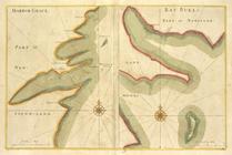
HARBOR GRACE part of
New
-Found-land; BAY
use:
… partner (e.g.,
New
York
The second section of the sur…
use:
… partner (e.g.,
New
York
Recens edita totius Novi Belg…
use:
… partner (e.g.,
New
York
Map of the vicinity of Niagar…
use:
… partner (e.g.,
New
York
The states of Maryland and De…
use:
… partner (e.g.,
New
York
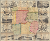
Niagara Falls: from surveys e…
use:
… partner (e.g.,
New
York
A
new
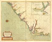
mapp of CAROLINA ; A large draught
use:
… partner (e.g.,
New
York
Nova Svecia
use:
… partner (e.g.,
New
York
…, Ludovicianae,
N
. Angliae
use:
… partner (e.g.,
New
York
… States. [W, X,
Y
, Z]
use:
… partner (e.g.,
New
York
New
England and
New
York
use:
… partner (e.g.,
New
York
… States. [M,
N
]
use:
… partner (e.g.,
New
York
… States. [
N
, O]
use:
… partner (e.g.,
New
York
Falls of Niagara and adjacent…
use:
… partner (e.g.,
New
York
A survey of Lake Champlain: i…
use:
… partner (e.g.,
New
York
A survey of Lake Champlain: i…
use:
… partner (e.g.,
New
York
A
new
mapp of America
use:
… partner (e.g.,
New
York
Plano del terreno en que se h…
use:
… partner (e.g.,
New
York
Part of North America: compre…
use:
… partner (e.g.,
New
York
A plan of Fort Montgomery & F…
use:
… partner (e.g.,
New
York
A
New
chart
use:
… partner (e.g.,
New
York
Title page
use:
… partner (e.g.,
New
York
… the islands and the
new
use:
… partner (e.g.,
New
York
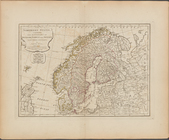
The Northern States, comprehe…
use:
… partner (e.g.,
New
York
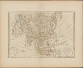
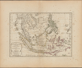
The East India Islands, compr…
use:
… partner (e.g.,
New
York
m
Niagara 1819
use:
… partner (e.g.,
New
York
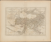
A map of Turkey in Asia, cont…
use:
… partner (e.g.,
New
York
m
Americae sive novi orbis, nov…
use:
… partner (e.g.,
New
York
Audience de Guadalajara, Nouv…
use:
… partner (e.g.,
New
York
Plano topografico de la ciuda…
use:
… partner (e.g.,
New
York
Chart of Long Island Sound, 1…
use:
… partner (e.g.,
New
York
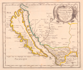
The State of Virginia from th…
use:
… partner (e.g.,
New
York
A
new
generall chart for the West
use:
… partner (e.g.,
New
York
aert vande Svyd Rivier in Nie…
collection:
Chart of the South River in
New
Sweden
Carte de la Virginie et du Ma…
use:
… partner (e.g.,
New
York
… of
New
-found-land; CATTALINA HARBOR part of
New
use:
… partner (e.g.,
New
York
New
map of the states of Georgia South
use:
… partner (e.g.,
New
York
Le nouveau monde descouvert e…
use:
… partner (e.g.,
New
York
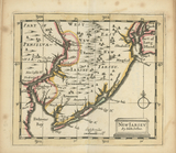
New
Iarsey
use:
… partner (e.g.,
New
York
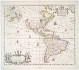
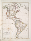
America
use:
… partner (e.g.,
New
York
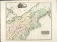
Northern provinces of the Uni…
use:
… partner (e.g.,
New
York
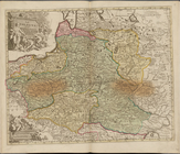
La Pologne, Plate 19
use:
… partner (e.g.,
New
York
A map of
New
Jersey …
use:
… partner (e.g.,
New
York
A
new
map of North America from the latest
use:
… partner (e.g.,
New
York
m
North America divided into it…
use:
… partner (e.g.,
New
York
…. Angleterre, la Nlle.
York
, le
New
Jersey, la
use:
… partner (e.g.,
New
York
1
2
3
4
5
6
7
8
Previous
Next
1
2
3
4
5
6
7
8
Previous
Next