Click to visit the main New York Public Library Homepage
The New York Public Library
Digital Collections
About Digital Collections
Browse
Search only public domain materials
Items
Collections
Divisions
Home
Search
Browse
About
Search only public domain materials
Items
Collections
Divisions
Digital Collections
Using Images
Using Data
Search
Filtered keyword search
Show filters
Hide filters
Show Only Public Domain
topic
Administrative and political divisions
425
Railroads
345
History
244
Landowners
224
Real property
218
More
Less
name
United States Coast Survey
129
Bache, A. D. (Alexander Dallas), 1806-1867
93
Burr, David H., 1803-1875
70
Bien, Julius, 1826-1909
62
Geological Survey (U.S.)
59
More
Less
collection
Maps of North America
1835
Maps of New York City and State
570
Lawrence H. Slaughter Collection of English maps, charts, globes, books and atlases
326
Atlases of the United States
64
Atlases of New York City
59
More
Less
place
New York (State)
541
United States
402
North America
215
New York (N.Y.)
198
Virginia
188
More
Less
genre
Maps
2973
Topographic maps
163
Cadastral maps
155
Nautical charts
104
Atlases
59
More
Less
publisher
publisher not identified
200
s.n
58
U.S. Coast Survey
51
U.S. Coast Survey Office
37
Topographical Bureau
34
More
Less
division
x
Map Division
type
cartographic
2970
still image
52
text
47
Date Range
to
Looking for this collection?
Maps of North America
3,345 items
2,976 results found for:
x
Reliefs
Filtering on:
x
Division
: Map Division
Sort by:
Relevance
Title
Date created
Date digitized
Sequence
Results 2501 - 2550
m
Map of Maury Co., Tennessee :…
abstract:
… physical features.
Relief
m
Map of the Catskill Mountains
note:
Relief
shown by hachures and spot heights.
m
Plan of a survey for a rail-r…
note:
Relief
shown by hachures.
Part of the boundary between …
note:
Relief
shown by hachures.
Map of Pittsburgh and its env…
abstract:
… factories.
Relief
shown
State of Kansas
abstract:
….
Relief
shown by hachures
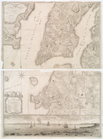
Topographical map of New York…
note:
Relief
shown by hachures. Depths shown
The town of Boston: in New En…
abstract:
… the upper right.
Relief
The harbor of Holmes' Hole: t…
note:
Relief
shown by hachures. Depths shown
Geological map of Isle Royale…
abstract:
… resources.
Relief
shown
m
Map of the Yellowstone Nation…
abstract:
… and proposed railroads.
Relief
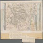
Military map of south-eastern…
abstract:
… in the Richmond-Petersburg area.
Relief
shown
m
Map of Jersey City and Hoboke…
note:
Relief
shown by hachures.
District of New Mexico
abstract:
….
Relief
shown by hachures
m
Map of Garrard and Lincoln co…
abstract:
Relief
shown by hachures. Includes business
Map exhibiting the salt marsh…
note:
Relief
shown by hachures. Depths shown
Map of Long Island: showing t…
note:
Relief
shown by hachures.
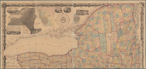
m
The State of New York: from n…
note:
Relief
shown by hachures.
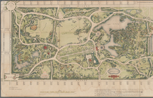
m
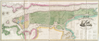
Map of the Central Park
note:
Shows
relief
by spot heights.
Map of the state of Montana
abstract:
….
Relief
shown by spot
A general map of the middle B…
note:
Relief
shown pictorially.
Map showing a portion of the …
note:
Relief
shown by hachures.
A sketch of the operations of…
note:
Relief
shown by hachures and shading
Nieuwe wassende graade zee ka…
note:
Relief
shown pictorially. Depths shown
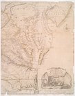
Carte de la Virginie et du Ma…
note:
Relief
shown pictorially.
The travellers guide, or, Map…
note:
Relief
shown by hachures.
A map of the British and Fren…
note:
Relief
shown pictorially.
Carte de la Louisiane et du c…
note:
Relief
shown pictorially.
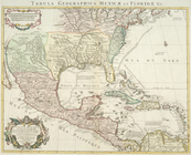
Carte du Mexique et de la Flo…
note:
Relief
shown pictorially.
A new and accurate map of the…
note:
Relief
shown pictorially.
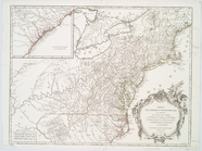
The provinces of New York, an…
note:
Relief
shown pictorially.
Mappa geographica Provinciae …
note:
Relief
shown by hachures.
A chart of New York Harbour :…
note:
Relief
shown by hachures and shading
A map of the most inhabited p…
note:
Relief
shown pictorially.
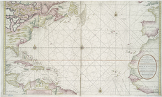
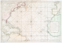
Carte réduite de l'Ocean occi…
note:
Depths shown by soundings.
Relief
shown
Plan of the city of New York …
note:
Relief
shown by hachures. Depths shown
m
A map of the most inhabited p…
note:
Relief
shown pictorially.
m
A map of the most inhabited p…
note:
Relief
shown pictorially.
Ensign's Travellers' guide an…
note:
Relief
shown by hachures.
Partie de l'Amérique septentr…
note:
Relief
shown pictorially.
Nova Virginiae tabvla
note:
Relief
shown pictorially.
Carte de la Nouvelle York : y…
note:
Relief
shown pictorially.
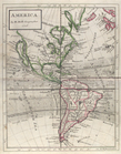
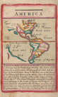
America
note:
Relief
shown pictorially.
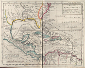
A map of the West-Indies &c. …
note:
Relief
shown pictorially.
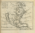
America.
note:
Relief
shown pictorially.
North America : according to …
note:
Relief
shown pictorially.
States of America, from the b…
note:
Relief
shown pictorially.
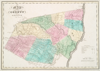
Map of the county of Greene
note:
Relief
shown by hachures.
Map of the city and county of…
note:
Relief
shown by hachures.
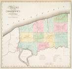
Map of the county of Niagara
note:
Relief
shown by hachures.
1
2
3
4
5
6
7
8
9
10
11
12
Previous
Next
1
2
3
4
5
6
7
8
9
10
11
12
Previous
Next