Click to visit the main New York Public Library Homepage
The New York Public Library
Digital Collections
About Digital Collections
Browse
Search only public domain materials
Items
Collections
Divisions
Home
Search
Browse
About
Search only public domain materials
Items
Collections
Divisions
Digital Collections
Using Images
Using Data
Search
Filtered keyword search
Show filters
Hide filters
Show Only Public Domain
topic
Administrative and political divisions
425
Railroads
345
History
244
Landowners
224
Real property
218
More
Less
name
United States Coast Survey
129
Bache, A. D. (Alexander Dallas), 1806-1867
93
Burr, David H., 1803-1875
70
Bien, Julius, 1826-1909
62
Geological Survey (U.S.)
59
More
Less
collection
Maps of North America
1835
Maps of New York City and State
570
Lawrence H. Slaughter Collection of English maps, charts, globes, books and atlases
326
Atlases of the United States
64
Atlases of New York City
59
More
Less
place
New York (State)
541
United States
402
North America
215
New York (N.Y.)
198
Virginia
188
More
Less
genre
Maps
2973
Topographic maps
163
Cadastral maps
155
Nautical charts
104
Atlases
59
More
Less
publisher
publisher not identified
200
s.n
58
U.S. Coast Survey
51
U.S. Coast Survey Office
37
Topographical Bureau
34
More
Less
division
x
Map Division
type
cartographic
2970
still image
52
text
47
Date Range
to
Looking for this collection?
Maps of North America
3,345 items
2,976 results found for:
x
Reliefs
Filtering on:
x
Division
: Map Division
Sort by:
Relevance
Title
Date created
Date digitized
Sequence
Results 2751 - 2800
Topographical map of Fairmoun…
abstract:
Relief
shown by contours and spot heights
Colorado, Tenmile District sp…
abstract:
Relief
shown by contours and spot heights
Pulgas Base, California
abstract:
….
Relief
shown by hachures
Rappahannock River, Virginia …
abstract:
Relief
shown by hachures; depths shown
Town of Greenburgh: Westchest…
note:
Relief
shown by hachures.
Preliminary chart of York Riv…
abstract:
Relief
shown by hachures. Depths shown
m
City of Houston, Harris Co., …
abstract:
….
Relief
shown pictorially
Map of the surveyed portions …
abstract:
… in Oregon Territory.
Relief
Reconnaissance of Catalina Ha…
abstract:
Relief
shown by hachures; depths shown
Entrance to Columbia River, O…
abstract:
Relief
shown by hachures. Depths shown
Carte reduite des costes de l…
abstract:
Relief
shown by hachures and pictorially
Map of Bennington County, Ver…
abstract:
….
Relief
shown by hachures.
m
A map of Schuylkill County, P…
abstract:
….
Relief
shown by hachures
Explorations in Alaska, 1898 …
abstract:
Relief
shown by contours and land forms
m
Map of Fulton Co., Pennsylvan…
abstract:
…, and landowners' names.
Relief
m
Map of New London County, Con…
note:
Relief
shown by hachures.
Preliminary chart of St. Andr…
note:
Relief
shown by hachures. Depths shown
Map of the country thirty thr…
note:
Relief
shown by hachures. Depths shown
The harbor of Wood's Hole, Ma…
abstract:
Relief
shown by hachures. Depths shown
Mare Island Straits, Californ…
abstract:
… and site of Vallejo.
Relief
m
Map of Orange and Rockland Co…
note:
Relief
shown by hachures.
D'Engelze volkplanting in Vir…
abstract:
…. and decorative border.
Relief
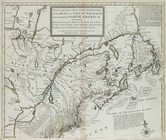
Carte de la Nouvelle France: …
note:
Relief
shown pictorially.
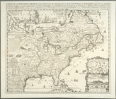
United States of Nth. America…
note:
Relief
shown pictorially.
Ensign's Travellers' guide an…
note:
Relief
shown by hachures.
Nova tabula geographica compl…
note:
Relief
shown pictorially. Depths shown
m
A new and exact map of the do…
note:
Relief
shown pictorially.
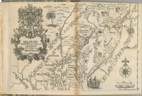
Delineatio Pennsilvaniae et C…
note:
Relief
shown pictorially.
Die vereinigten Staaten von N…
note:
Relief
shown by hachures.
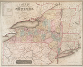
Map of the state of New-York …
note:
Relief
shown by hachures.
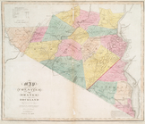
Map of the counties of Orange…
note:
Relief
shown by hachures.
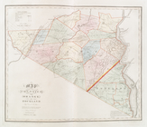
Map of the counties of Orange…
note:
Relief
shown by hachures.
A new and correct map of Amer…
note:
Relief
shown pictorially.
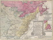
A map of New England, New Yor…
note:
Relief
shown pictorially.
Plan of the city of New York …
note:
Relief
shown by hachures. Depths shown
Alaska Peninsula and adjacent…
abstract:
Relief
shown by hatchures. Depths shown
Second Geological Survey of P…
note:
Relief
shown by contours.
Map of the state of Georgia :…
abstract:
….
Relief
shown by hachures
Map of the country thirty thr…
note:
Relief
shown by hachures. Depths shown
Map of the route of the new C…
note:
Relief
shown by hachures.
California (Nevada Co.), Neva…
note:
Relief
shown by contours, hachures and spot
The Yukon River, Alaska : fro…
abstract:
Relief
shown by hachures. Includes location
Explorations in Alaska, 1898 …
abstract:
Relief
shown by contours and spot heights
Explorations in Alaska, 1898 …
abstract:
Relief
shown by contours. Contour interval
Johnson's Nebraska, Dakota, I…
abstract:
Relief
shown by hachures and spot heights
m
Map of Cayuga and Seneca Coun…
note:
Relief
shown by hachures.
Territory of Dakota
abstract:
… physical features.
Relief
Map no. 1 from San Francisco …
abstract:
….
Relief
shown by hachures
Reconnaissance of Port Townsh…
abstract:
Relief
shown by hachures. Depths shown
Colorado (Dolores County), Ri…
abstract:
….
Relief
shown by contours
1
2
3
4
5
6
7
8
9
10
11
12
Previous
Next
1
2
3
4
5
6
7
8
9
10
11
12
Previous
Next