Click to visit the main New York Public Library Homepage
The New York Public Library
Digital Collections
About Digital Collections
Browse
Search only public domain materials
Items
Collections
Divisions
Home
Search
Browse
About
Search only public domain materials
Items
Collections
Divisions
Digital Collections
Using Images
Using Data
Search
Filtered keyword search
Show filters
Hide filters
Show Only Public Domain
topic
Administrative and political divisions
425
Railroads
345
History
244
Landowners
224
Real property
218
More
Less
name
United States Coast Survey
129
Bache, A. D. (Alexander Dallas), 1806-1867
93
Burr, David H., 1803-1875
70
Bien, Julius, 1826-1909
62
Geological Survey (U.S.)
59
More
Less
collection
Maps of North America
1835
Maps of New York City and State
570
Lawrence H. Slaughter Collection of English maps, charts, globes, books and atlases
326
Atlases of the United States
64
Atlases of New York City
59
More
Less
place
New York (State)
541
United States
402
North America
215
New York (N.Y.)
198
Virginia
188
More
Less
genre
Maps
2973
Topographic maps
163
Cadastral maps
155
Nautical charts
104
Atlases
59
More
Less
publisher
publisher not identified
200
s.n
58
U.S. Coast Survey
51
U.S. Coast Survey Office
37
Topographical Bureau
34
More
Less
division
x
Map Division
type
cartographic
2970
still image
52
text
47
Date Range
to
Looking for this collection?
Maps of North America
3,345 items
2,976 results found for:
x
Reliefs
Filtering on:
x
Division
: Map Division
Sort by:
Relevance
Title
Date created
Date digitized
Sequence
Results 751 - 800
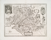
Nova Virginiae tabvla.
note:
Relief
shown pictorially.
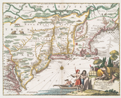
Novi Belgii, quod nunc Novi J…
note:
Relief
shown pictorially.
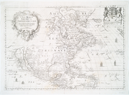
A new mapp of America Septent…
note:
Relief
shown pictorially.
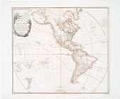
A map of America or the New W…
note:
Relief
shown pictorially.
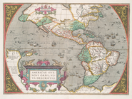
Americae sive novi orbis, nov…
note:
Relief
shown pictorically.
Map of America
note:
Relief
shown by hachures.
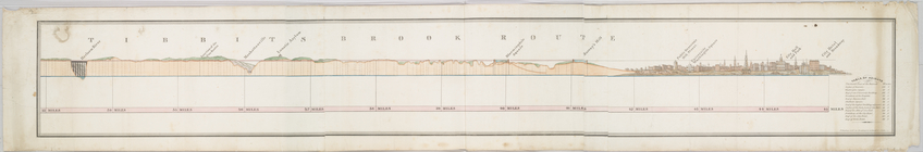
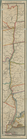
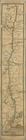
Tibbits Brook route.
note:
Relief
shown by profile.
Military movements in Pennsyl…
note:
Relief
shown by hachures.
Plan des forts, batteries et …
note:
Relief
shown by hachures.
Ville de Manathe ou Nouvelle-…
note:
Relief
shown by hachures.
Map and plan to illustrate th…
note:
Relief
shown by hachures.
Fort Washington and the north…
note:
Relief
shown by hachures.
The Great metropolis in 1804.
note:
Relief
shown by hachures.
An accurate map of the Englis…
note:
Relief
shown pictorially.
Operations in the Delaware, O…
note:
Relief
shown by hachures.
Carta della Nuova Inghilterra…
note:
Relief
shown pictorially.
New Jersey
note:
Relief
shown by hachures.
New York Harbor and entrance …
note:
Relief
shown by hachures. Depths shown
Map of part of the United Sta…
note:
Relief
shown by hachures.
A map of the canals & rail ro…
note:
Relief
shown by hachures.
m
An improved map of the Hudson…
note:
Relief
shown by hachures and spot heights.
Pennsylvania
note:
Relief
shown by hachures.
A map of the canals & rail ro…
note:
Relief
shown by hachures.
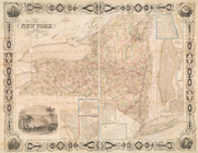
Map of the state of New York
note:
Relief
shown by hachures.
Survey of the several routes …
note:
Relief
shown by hachures.
A new and accurate map of the…
note:
Relief
shown pictorially.
Hudson River & vicinity
note:
Relief
shown by hachures.
Plan af Philadelphia
note:
Relief
shown by hachures.
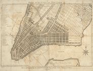
Plan of the city of New York
note:
Relief
shown by hachures.
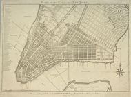
Plan of the city of New York
note:
Relief
shown by hachures.
A New and accurate map of the…
note:
Relief
shown pictorially.
Map of Pennsylvania and New J…
note:
Relief
shown by hachures.
Map of the United States show…
note:
Relief
shown by hachures.
United States
note:
Relief
shown by hachures.
North America : sheet VII, Pe…
note:
Relief
shown by hachures.
A map of the British and Fren…
note:
Relief
shown pictorially.
L'Amérique septentrionale : d…
note:
Relief
shown pictorially.
Map of the United States of A…
note:
Relief
shown by hachures.
Carte physique et politique d…
note:
Relief
shown by hachures.
Map of the United States of A…
note:
Relief
shown by hachures.
A Map of the frontier of Brit…
note:
Relief
shown by hachures.
A map of the United States of…
note:
Relief
shown pictorially.
Special-Karte der Vereinicten…
note:
Relief
shown by hachures.
m
Hudson River & vicinity
note:
Relief
shown by hachures.
An Accurate map of the presen…
note:
Relief
shown pictorially.
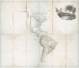
A map of North America with t…
note:
Relief
shown pictorially.
A new map of the north parts …
abstract:
…., and text.
Relief
shown
Amerique Septentrionale
note:
Relief
shown pictorially.
L'Amerique septentrionale : d…
note:
Relief
shown pictorially.
Amérique septentrionale dress…
note:
Relief
shown pictorially.
1
2
3
4
5
6
7
8
9
10
11
12
Previous
Next
1
2
3
4
5
6
7
8
9
10
11
12
Previous
Next