Click to visit the main New York Public Library Homepage
The New York Public Library
Digital Collections
About Digital Collections
Browse
Search only public domain materials
Items
Collections
Divisions
Home
Search
Browse
About
Search only public domain materials
Items
Collections
Divisions
Digital Collections
Using Images
Using Data
Search
Filtered keyword search
Show filters
Hide filters
Show Only Public Domain
topic
Administrative and political divisions
425
Railroads
345
History
244
Landowners
224
Real property
218
More
Less
name
United States Coast Survey
129
Bache, A. D. (Alexander Dallas), 1806-1867
93
Burr, David H., 1803-1875
70
Bien, Julius, 1826-1909
62
Geological Survey (U.S.)
59
More
Less
collection
Maps of North America
1835
Maps of New York City and State
570
Lawrence H. Slaughter Collection of English maps, charts, globes, books and atlases
326
Atlases of the United States
64
Atlases of New York City
59
More
Less
place
New York (State)
541
United States
402
North America
215
New York (N.Y.)
198
Virginia
188
More
Less
genre
Maps
2973
Topographic maps
163
Cadastral maps
155
Nautical charts
104
Atlases
59
More
Less
publisher
publisher not identified
200
s.n
58
U.S. Coast Survey
51
U.S. Coast Survey Office
37
Topographical Bureau
34
More
Less
division
x
Map Division
type
cartographic
2970
still image
52
text
47
Date Range
to
Looking for this collection?
Maps of North America
3,345 items
2,976 results found for:
x
Reliefs
Filtering on:
x
Division
: Map Division
Sort by:
Relevance
Title
Date created
Date digitized
Sequence
Results 1001 - 1050
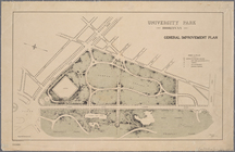
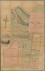
University Park, Brooklyn, N.…
abstract:
… index.
Relief
shown
Portions of 1st, 2nd, and 3rd…
note:
Relief
shown by hachures.
Plan of the town of Boston an…
note:
Relief
shown by shading. Depths shown
Asher & Adams' United States …
note:
Relief
shown by hachures and spot heights.
Map of property on the highla…
note:
Relief
shown by spot heights.
Map of Brooklyn during the Ba…
m
New York and vicinity : accom…
note:
Relief
shown by hachures.
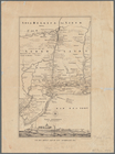
Rand, McNally & Co.'s Georgia
abstract:
… physical features.
Relief
Boston and surroundings
note:
Relief
shown by spot heights.
[Map of eastern Cape Cod, Mas…
note:
Relief
shown by hachures.
General plan of Franklin Park…
note:
Relief
shown by spot heights.
Adirondack survey, sketch sho…
note:
Relief
shown by hachures.
Hawaiian or Sandwich Islands
abstract:
… by soundings;
relief
shown
m
Map of the states of North Ca…
note:
Relief
shown pictorially.
Map of the Department of the …
note:
Relief
shown by hachures.
Rand McNally & Co.'s Maryland…
abstract:
Relief
shown by hachures. Includes insets
Map of the United States with…
note:
Relief
shown by hachures.
Middle Georgia & South Caroli…
abstract:
….
Relief
shown by hachures.
Hints for the lay-out of East…
note:
Relief
shown by land forms.
Map of property at New Bright…
note:
Relief
shown by shading and hachures.
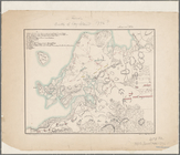
Map of Maine & the disputed …
note:
Relief
shown by hachures.
Photolithograph of preliminar…
note:
Relief
shown by contours.
Washington Territory
abstract:
….
Relief
shown by hachures
Stedman's new map of the city…
note:
Relief
shown by hachures.
South-Carolina and parts adja…
abstract:
… and skirmishes.
Relief
shown
Map of North Carolina and Sou…
abstract:
… features.
Relief
shown
Plan of York Town in Virginia…
abstract:
…."
Relief
shown by hachures.
Map of North America
note:
Relief
shown by hachures.
Pennsylvania : eastern part
note:
Relief
shown by hachures and contours.
Van Der Donck's map of New Ne…
note:
Relief
shown pictorially.
Johnson's Vermont, New Hampsh…
note:
Relief
shown by hachures.
A new map of Carolina
abstract:
Relief
shown pictorially, depths shown
Map of the states of North & …
note:
Shows roads, towns, and county boundaries.
Relief
m
Schonberg's imperial map of t…
note:
Relief
shown by hachures.
Map of the town of Needham, M…
note:
Relief
shown by hachures.
Chart of Lake Ontario
note:
Depths shown by soundings.
Relief
shown
Vereinigte Staaten von Nord-A…
note:
Relief
shown by hachures and spot heights.
Rand McNally & Co.'s new offi…
abstract:
Relief
shown by hachures. Prime meridian
m
A new description of Carolina
abstract:
….
Relief
shown pictorially
The United States, southern p…
note:
Relief
shown by hachures.
Plan of McLean Hospital lands…
note:
Relief
shown by hachures.
Hawaii
abstract:
… the Pacific Rim.
Relief
shown
Map of Oregon, Washington, Id…
note:
Relief
shown by hachures.
Rapid Transit Commission, pla…
note:
Relief
shown by hachures.
Map of eastern Virginia
abstract:
… physical features.
Relief
Map of New England and the pr…
note:
Relief
shown by hachures.
Map of part of Virginia, Nort…
note:
Relief
shown by hachures.
Map no. 12, Port Hudson and v…
note:
Relief
shown by hachures.
Map of first district, Campbe…
note:
Relief
shown by hachures
An accurate map of the Distri…
note:
Relief
shown pictorially
1
2
3
4
5
6
7
8
9
10
11
12
Previous
Next
1
2
3
4
5
6
7
8
9
10
11
12
Previous
Next