Click to visit the main New York Public Library Homepage
The New York Public Library
Digital Collections
About Digital Collections
Browse
Search only public domain materials
Items
Collections
Divisions
Home
Search
Browse
About
Search only public domain materials
Items
Collections
Divisions
Digital Collections
Using Images
Using Data
Search
Filtered keyword search
Show filters
Hide filters
Show Only Public Domain
topic
Administrative and political divisions
425
Railroads
345
History
244
Landowners
224
Real property
218
More
Less
name
United States Coast Survey
129
Bache, A. D. (Alexander Dallas), 1806-1867
93
Burr, David H., 1803-1875
70
Bien, Julius, 1826-1909
62
Geological Survey (U.S.)
59
More
Less
collection
Maps of North America
1835
Maps of New York City and State
570
Lawrence H. Slaughter Collection of English maps, charts, globes, books and atlases
326
Atlases of the United States
64
Atlases of New York City
59
More
Less
place
New York (State)
541
United States
402
North America
215
New York (N.Y.)
198
Virginia
188
More
Less
genre
Maps
2973
Topographic maps
163
Cadastral maps
155
Nautical charts
104
Atlases
59
More
Less
publisher
publisher not identified
200
s.n
58
U.S. Coast Survey
51
U.S. Coast Survey Office
37
Topographical Bureau
34
More
Less
division
x
Map Division
type
cartographic
2970
still image
52
text
47
Date Range
to
Looking for this collection?
Maps of North America
3,345 items
2,976 results found for:
x
Reliefs
Filtering on:
x
Division
: Map Division
Sort by:
Relevance
Title
Date created
Date digitized
Sequence
Results 1751 - 1800
Map of the city of Saint Paul…
abstract:
….
Relief
shown by hachures.
A geological map of the Black…
abstract:
… and leaders' names.
Relief
m
The Chickahominy from Mechani…
note:
Relief
shown by hachures.
Erie Canal enlargement, middl…
note:
Relief
on ancillary map shown by hachures.
Vingboons map of Manhattan, 1…
note:
Relief
shown pictorially. Depths shown
The legacy of New Sweden: Swe…
note:
Relief
shown by gradient tints.
Colton's map of Virginia, Mar…
abstract:
…, and New York.
Relief
shown
Map of the New York wildernes…
note:
Relief
shown by hachures and spot heights.
A new and exact map of the do…
note:
Relief
shown pictorially.
A diagram of Oregon
abstract:
Relief
shown by hachures. "Sen. ex. doc. no
Map showing the proposed Tenn…
abstract:
…
relief
by hachures
Sketch of the Yellowstone Lak…
note:
Relief
shown by hachures.
m
A map of South Carolina : wit…
abstract:
… physical features.
Relief
m
Washington County, Maryland: …
abstract:
Relief
shown by hachures. Also includes
A new and accurate map of eas…
note:
Relief
shown pictorially.
Map of the Catskill Mountains…
note:
Relief
shown by hachures.
Colton's excursion map of Nor…
note:
Relief
shown by spot heights. Depths
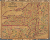
A new county map of the state…
note:
Relief
shown by hachures.
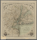
Sketch map of the city of New…
note:
Relief
shown by hachures.
m
A map of the most inhabited p…
note:
Relief
shown pictorially.
m
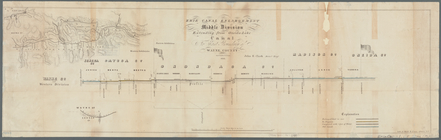
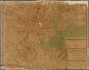
Map of the Passaic and Croton…
note:
Relief
shown by hachures.
Map showing the Southern Mary…
abstract:
Relief
shown by hachures. Shows Maryland
m
Topographical map of the Wyom…
abstract:
….
Relief
shown by hachures
Map of the country thirty thr…
note:
Relief
shown by hachures; depths shown
Map of the state of South Car…
abstract:
… features.
Relief
shown
Lloyd's map of the Canadas, N…
note:
Relief
shown by hachures.
Plate I: General map of the P…
note:
Relief
shown by contours.
m
Map of New York City : showin…
note:
Relief
shown by hachures and spot heights.
Map of the Upper Geyser Basin…
note:
Relief
shown by shading and spot heights.
Map of the Department of the …
note:
Relief
shown by hachures and spot heights.
Arbachoochee, Alabama : Dense…
abstract:
….
Relief
shown by hachures
Map of the Stoney Creek bitum…
abstract:
Relief
shown by hachures. Prime meridian
Bancroft's map of California,…
abstract:
… reservations, etc.
Relief
shown
Map of Conanicut Island, oppo…
note:
Relief
shown by contours. Shows streets
Mitchell's county and townshi…
note:
Relief
shown by hachures.
Reconnaissance of the Pamunky…
abstract:
Relief
shown by landform drawings. Oriented
State of Louisiana : compiled…
note:
Relief
shown by hachures.
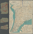
Map of Richmond, Virginia, an…
abstract:
… physical features.
Relief
[Photographic copy of a print…
note:
Relief
shown by contour lines.
Upper Geyser Basin
note:
Relief
shown by hachures.
Plan of the town of Brooklyn …
note:
Relief
shown by hachures. Depths shown
Rand, McNally & Co.'s Vermont
note:
Relief
shown by hachures.
Rand, McNally & Co.'s Rhode I…
note:
Relief
shown by hachures.
Territory of New Mexico
abstract:
… limits.
Relief
shown
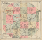
Map of the Vilas Preserve and…
note:
Relief
shown by hachures.
A plan of the battle, on Bunk…
abstract:
Relief
shown by hachures and pictorially
Map of the states of Californ…
note:
Relief
by shown by hachures and spot heights.
Road map of Westchester Co., …
note:
Relief
shown by hachures.
m
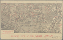
Bird's-eye view of the Catski…
note:
Relief
shown by hachures, pictorially
m
Map of the portion of the Con…
note:
Depths shown by bathymetric contours.
Relief
1
2
3
4
5
6
7
8
9
10
11
12
Previous
Next
1
2
3
4
5
6
7
8
9
10
11
12
Previous
Next