Click to visit the main New York Public Library Homepage
The New York Public Library
Digital Collections
About Digital Collections
Browse
Search only public domain materials
Items
Collections
Divisions
Home
Search
Browse
About
Search only public domain materials
Items
Collections
Divisions
Digital Collections
Using Images
Using Data
Search
Filtered keyword search
Show filters
Hide filters
Show Only Public Domain
topic
Real property
10812
Fire insurance
5289
Cities & towns
5001
Administrative and political divisions
906
Railroads
784
More
Less
name
Sanborn Map Company
5093
G.W. Bromley & Co
2471
Bromley, George Washington
797
Bromley, Walter Scott
797
Austro-Hungarian Monarchy. Militärgeographisches Institut
773
More
Less
collection
Atlases of New York City
10577
Atlases of the United States
3749
Maps of North America
3345
Maps of New York City and State
2046
Lawrence H. Slaughter Collection of English maps, charts, globes, books and atlases
1101
More
Less
place
New York (State)
12153
New York
3978
New York (N.Y.)
2423
Manhattan (New York, N.Y.)
2371
Brooklyn (New York, N.Y.)
1166
More
Less
genre
Maps
24593
Atlases
3679
Topographic maps
1062
Surveys
1032
land surveys
849
More
Less
publisher
Sanborn Map Company
5129
G.W. Bromley & Co
2294
E. Belcher Hyde
780
K.u.K. Militargeographisches Institut
773
publisher not identified
452
More
Less
division
Map Division
22270
Manuscripts and Archives Division
1079
General Research Division
400
Rare Book Division
320
Schomburg Jean Blackwell Hutson Research and Reference Division
191
More
Less
type
x
cartographic
text
647
still image
322
Date Range
to
Looking for one of these collections?
Atlases of New York City
11,722 items
Atlases of the United States
3,868 items
Maps of North America
3,345 items
Maps of New York City and State
2,059 items
Lawrence H. Slaughter Collection of English maps, charts, globes, books and atlases
1,252 items
Bancker plans
1,080 items
24,808 results found for:
x
New York Maps
Filtering on:
x
Type
: cartographic
Sort by:
Relevance
Title
Date created
Date digitized
Sequence
Results 501 - 550
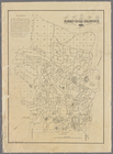
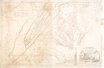
Map
of
New
Jersey and Pennsylvania : exhibiting
use:
… partner (e.g.,
New
York
Nova Anglia, Novum Belgium, e…
use:
… partner (e.g.,
New
York
Delaware, from the best autho…
use:
… partner (e.g.,
New
York
A
new
and correct
map
of North America
use:
… partner (e.g.,
New
York
Virginiae item et Floridae Am…
use:
… partner (e.g.,
New
York
Baye de la Delaware avec les …
use:
… partner (e.g.,
New
York
Map
of the routes through the middle
use:
… partner (e.g.,
New
York
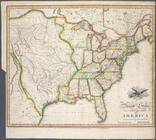
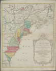
United States of America
use:
… partner (e.g.,
New
York
…
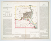
map
of the District
use:
… partner (e.g.,
New
York
Plan of the city of Washingto…
use:
… partner (e.g.,
New
York
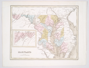
Maryland
use:
… partner (e.g.,
New
York
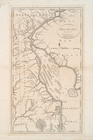
Nova Virginiae tabula.
use:
… partner (e.g.,
New
York
Maryland und Delaware
use:
… partner (e.g.,
New
York
Delaware
use:
… partner (e.g.,
New
York
A Generall chart for the West…
use:
… partner (e.g.,
New
York
Carte de la Louisiane cours d…
use:
… partner (e.g.,
New
York
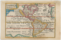
America
use:
… partner (e.g.,
New
York
An Accurate
map
of the present seat of war
use:
… partner (e.g.,
New
York
A
map
of Florida and ye Great Lakes
use:
… partner (e.g.,
New
York
Messico, ouvero Nuova-Spagna …
use:
… partner (e.g.,
New
York
A
new
and accurate
map
of North America
use:
… partner (e.g.,
New
York
Territory of Columbia
use:
… partner (e.g.,
New
York
A
map
of the states of Virginia, North Carolina
use:
… partner (e.g.,
New
York
… of Pensilvania,
New
Jersey
use:
… partner (e.g.,
New
York
m
Greenwood cemetery.
use:
… partner (e.g.,
New
York
Carte nouvelle de l'Amerique …
use:
… partner (e.g.,
New
York
… in the City of
New
York
use:
… partner (e.g.,
New
York
New
York
and Perthamboy Harbours.
use:
… partner (e.g.,
New
York
New
-
York
.
use:
… partner (e.g.,
New
York
The state of
New
York
from the most
use:
… partner (e.g.,
New
York
…., state of
New
York
use:
… partner (e.g.,
New
York
A
new
map
of the United States of America
use:
… partner (e.g.,
New
York
Plan of the city of Philadelp…
use:
… partner (e.g.,
New
York
Map
of the middle states of America
use:
… partner (e.g.,
New
York
Part of
New
England
New
York
East
New
I[J
use:
… partner (e.g.,
New
York
m
Strip
maps
of the "Dixie trail" north
use:
… partner (e.g.,
New
York
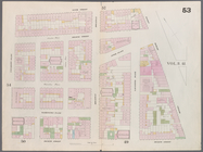
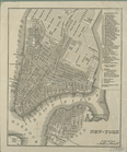
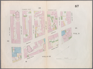
Map
bounded by Murray Street, Broadway
use:
… partner (e.g.,
New
York
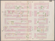
Map
bounded by Canal Street, Elm Street
use:
… partner (e.g.,
New
York
Map
bounded by Hamersley Street, Varick
use:
… partner (e.g.,
New
York
Map
bounded by Spring Street, Broadway
use:
… partner (e.g.,
New
York
Map
bounded by Broome Street, Bowery
use:
… partner (e.g.,
New
York
Map
bounded by Houston Street, Bowery
use:
… partner (e.g.,
New
York
Map
bounded by Rivington Street, Ludlow
use:
… partner (e.g.,
New
York
Map
bounded by Division Street, Montgomery
use:
… partner (e.g.,
New
York
Map
bounded by 5th Street, First Avenue
use:
… partner (e.g.,
New
York
Map
bounded by 4th Street, Bowery, Houston
use:
… partner (e.g.,
New
York
m
Map
bounded by 9th Street, Fourth Avenue
use:
… partner (e.g.,
New
York
Map
bounded by 9th Street, University Place
use:
… partner (e.g.,
New
York
Map
bounded by 14th Street, Fourth Avenue
use:
… partner (e.g.,
New
York
Map
bounded by 14th Street, University Place
use:
… partner (e.g.,
New
York
1
2
3
4
5
6
7
8
9
10
…
99
100
Previous
Next
1
2
3
4
5
6
7
8
9
10
…
99
100
Previous
Next