Click to visit the main New York Public Library Homepage
The New York Public Library
Digital Collections
About Digital Collections
Browse
Search only public domain materials
Items
Collections
Divisions
Home
Search
Browse
About
Search only public domain materials
Items
Collections
Divisions
Digital Collections
Using Images
Using Data
Search
Keyword search
Show filters
Hide filters
Show Only Public Domain
topic
Real property
11050
Fire insurance
5305
Cities & towns
5016
City planning
1101
Social conditions
946
More
Less
name
Sanborn Map Company
5108
G.W. Bromley & Co
2551
New York (N.Y.). City Planning Commission
980
M.I.T. Press
942
Bromley, George Washington
857
More
Less
collection
Atlases of New York City
11722
Atlases of the United States
3868
Maps of North America
3345
Maps of New York City and State
2059
Lawrence H. Slaughter Collection of English maps, charts, globes, books and atlases
1252
More
Less
place
New York (State)
14041
New York
5623
New York (N.Y.)
3511
Manhattan (New York, N.Y.)
2385
Brooklyn (New York, N.Y.)
1222
More
Less
genre
Maps
25787
Atlases
3791
Prints
1428
Topographic maps
1062
Surveys
1034
More
Less
publisher
Sanborn Map Company
5145
G.W. Bromley & Co
2371
MIT Press
942
E. Belcher Hyde
807
K.u.K. Militargeographisches Institut
774
More
Less
division
Map Division
23798
Manuscripts and Archives Division
1281
Wallach Division: Print Collection
746
Rare Book Division
518
Dorot Jewish Division
477
More
Less
type
cartographic
24808
still image
3785
text
2063
notated music
10
sound recording
3
More
Less
Date Range
to
Looking for one of these collections?
Atlases of New York City
11,722 items
Atlases of the United States
3,868 items
Maps of North America
3,345 items
Maps of New York City and State
2,059 items
Lawrence H. Slaughter Collection of English maps, charts, globes, books and atlases
1,252 items
Bancker plans
1,080 items
28,779 results found for:
maps
Sort by:
Relevance
Title
Date created
Date digitized
Sequence
Results 25251 - 25300
… [
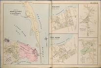
Map
bounded by New
note:
Includes index
map
.
… [
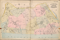
Map
bounded by Ohio
note:
Includes index
map
.
… [
Map
bounded
note:
Includes index
map
.
… [
Map
bounded
note:
Includes index
map
.
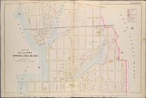
… [
Map
bounded by Inside
note:
Includes index
map
.
… [
Map
bounded by Huron
note:
Includes index
map
.
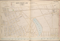
… [
Map
bounded by Clam
note:
Includes index
map
.
… [
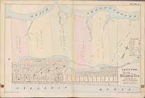
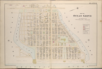
Map
bounded by Beach
note:
Includes index
map
.
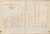
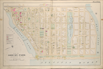
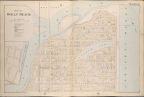
… [
Map
bounded by Beach
note:
Includes index
map
.
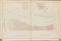
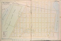
… [
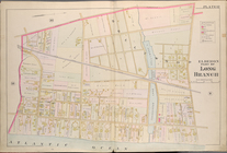
Map
bounded by Beach
note:
Includes index
map
.
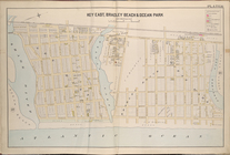
… [
Map
bounded by Risleys
note:
Includes index
map
.
Index
Index
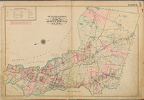
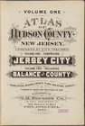
Volume One. Atlas of Hudson C…
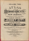
Volume Two. Atlas of Hudson C…
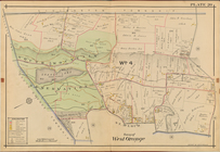
Town of West Orange, Double P…
m
Wolbrom: sefer-yizḳor li-she…
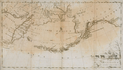
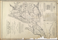
Chart of part of the Coast of…
Map
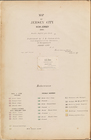
of Jersey City, New Jersey, 1866
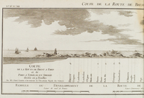
Coupe de la route de Brest à …
Street Index
Index
Map
Karta Shelekhova. Stranstvova…
… [
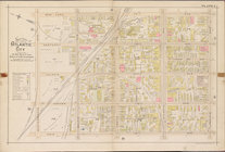
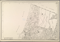
Map
Bounded by Public
… [
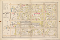
Map
Bounded
… [
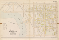
Map
of plan
… [
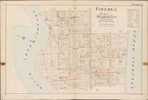
Map
Bounded
… [
Map
Bounded by Union
… [
Map
Bounded by Joline
… [
Map
Bounded by Avenue
… [
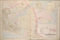
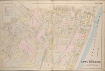
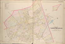
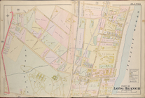
Map
Bounded by Deal
… [
Map
Bounded by Deal
… [
Map
Bounded
… [
Map
Bounded
… [
Map
Bounded by Shark
… [
Map
Bounded
… [
Map
Bounded
… [
Map
Bounded by Sea
… [
Map
Bounded
… [
Map
Bounded by Fulton
… [
Map
Bounded by Elm St
… [
Map
Bounded by North
… [
Map
Bounded by North
… [
Map
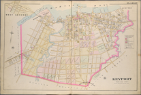
Bounded by Raritan
… [
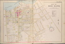
Map
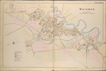
Bounded by Matawan
… [
Map
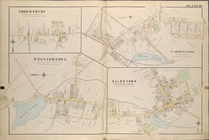
of Farmingdale
… [
Map
of Oceanic, Middle
… [
Map
of Eaton Town
… Use District
Map
Height District
Map
Section No. 1
note:
…"The Amended area district
map
consists
1
2
…
99
100
101
102
103
104
105
106
…
115
116
Previous
Next
1
2
…
99
100
101
102
103
104
105
106
…
115
116
Previous
Next